Pont-du-Château geodata
Pont-du-Château (Auvergne-Rhône-Alpes) is a populated place; located in France in Europe/Paris (GMT+2) time zone. With population of 9,474 people, there are 1009 cities with bigger population in this country. Compared to other cities in France, 69.3% of cities are located further ↑North; 61.3% of cities are located further ←West and 82.6% of cities have lower elevation than Pont-du-Château. Note1
Administrative division(s):
- Level 1: Auvergne-Rhône-Alpes
- Level 2: Département du Puy-de-Dôme
- Level 3: Arrondissement de Clermont-Ferrand
- Level 4: Pont-du-Château


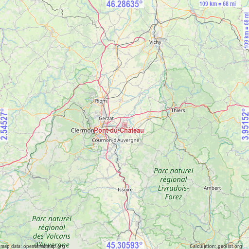
Pont-du-Château GPS coordinates[2]
45° 47' 53.88" North, 3° 14' 54.204" East
| Map corner | latitude | longitude |
|---|---|---|
| Upper-left | 46.28635°, | 2.54527° |
| Center: | 45.7983°, | 3.24839° |
| Lower-right: | 45.30593°, | 3.95152° |
| Map W x H: | 109×109 km | = 67.7×67.7mi |
| max Lat: | 51.07786° ⇑69.3% North |
| Pont-du-Château: | 45.7983° |
| min Lat: | ⇓30.7% South 41.3874° |
| min Long | Pont-du-Châtea | max Long |
| -5.08615° | 3.24839° | 9.52242° |
| W 61.3%⇐ | ⇒38.7% E |
Elevation
Elevation of Pont-du-Château is 317 m = 1040 ft, and this is 123.3 m = 405 ft above average elevation for this country.
| Max E: |
2333 m = 7654 ft | 17.4% |
| Pont-du-Château | 317 m 1040 ft | |
| Avg. | 193.7 m = 635 ft | |
Min E: |
-1 m = -3 ft | 82.6% |
See also: France elevation on elevation.city.
Geographical zone
Pont-du-Château is located in North temperate zone (between Tropic of Cancer and the Arctic Circle). Distance of this North polar circle is 2308.9 km =1434.7 mi to North.| Distance of | km | miles | from Pont-du-Château |
|---|---|---|---|
| North Pole | 4914.8 | 3053.9 | to North |
| Arctic Circle | 2308.9 | 1434.7 | to North |
| Tropic Cancer | 2486.4 | 1545 | to South |
| Equator | 5092.3 | 3164.2 | to South |


Nearby cities:
15 places around Pont-du-Château: (largest is in red/bold)
• Aulnat
6.3 km =3.9 mi,  271°
271°
• Bouzel
5.8 km =3.6 mi,  113°
113°
• Chappes
8.1 km =5 mi,  344°
344°
• Chauriat
5.7 km =3.5 mi,  155°
155°
• Cournon-d’Auvergne
7.5 km =4.7 mi,  212°
212°
• Dallet
3.2 km =2 mi,  193°
193°
• Joze
8.3 km =5.2 mi,  30°
30°
• Les Martres-d'Artière
4.1 km =2.5 mi,  19°
19°
• Lussat
5.2 km =3.2 mi,  330°
330°
• Malintrat
5.2 km =3.2 mi,  291°
291°
• Mezel
4.8 km =3 mi, 185°
• Moissat Haut
8.5 km =5.3 mi, 107°
• Pérignat-sur-Allier
7.9 km =4.9 mi, 189°
• Saint-Beauzire
7.8 km =4.8 mi,  316°
316°
• Vertaizon
4.3 km =2.7 mi,  136°
136°
Sources, notices
• [Note1] Compared only with cities in France existing in our database
• [Src1] Map data: © OpenStreetMap contributors (CC-BY-SA)
• [Src2] Other city data from geonames.org with taken over terms of usage.
• [Src3] Geographical zone / Annual Mean Temperature by Robert A. Rohde @ Wikipedia
