Plounévez-Moëdec geodata
Plounévez-Moëdec (Brittany) is a populated place; located in France in Europe/Paris (GMT+2) time zone. With population of 1,398 people, there are 6613 cities with bigger population in this country. Compared to other cities in France, 70% of cities are located further ↓South; 98.2% of cities are located further →East and 61.6% of cities have lower elevation than Plounévez-Moëdec. Note1
Administrative division(s):
- Level 1: Brittany
- Level 2: Département des Côtes-d’Armor
- Level 3: Arrondissement de Lannion
- Level 4: Plounévez-Moëdec


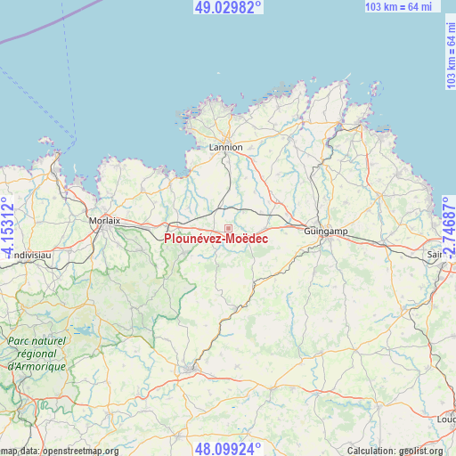
Plounévez-Moëdec GPS coordinates[2]
48° 34' 0.012" North, 3° 27' 0" West
| Map corner | latitude | longitude |
|---|---|---|
| Upper-left | 49.02982°, | -4.15312° |
| Center: | 48.56667°, | -3.45° |
| Lower-right: | 48.09924°, | -2.74687° |
| Map W x H: | 103.5×103.5 km | = 64.3×64.3mi |
| max Lat: | 51.07786° ⇑30% North |
| Plounévez-Moëdec: | 48.56667° |
| min Lat: | ⇓70% South 41.3874° |
| min Long | Plounévez-Moë | max Long |
| -5.08615° | -3.45° | 9.52242° |
| W 1.8%⇐ | ⇒98.2% E |
Elevation
Elevation of Plounévez-Moëdec is 178 m = 584 ft, and this is 15.7 m = 52 ft below average elevation for this country.
| Max E: |
2333 m = 7654 ft | 38.4% |
| Avg. | 193.7 m = 635 ft | |
| Plounévez-Moëdec | 178 m = 584 ft | |
Min E: |
-1 m = -3 ft | 61.6% |
See also: France elevation on elevation.city.
Geographical zone
Plounévez-Moëdec is located in North temperate zone (between Tropic of Cancer and the Arctic Circle). Distance of this North polar circle is 2001.1 km =1243.4 mi to North.| Distance of | km | miles | from Plounévez-Moëdec |
|---|---|---|---|
| North Pole | 4607 | 2862.7 | to North |
| Arctic Circle | 2001.1 | 1243.4 | to North |
| Tropic Cancer | 2794.2 | 1736.2 | to South |
| Equator | 5400.1 | 3355.5 | to South |


Nearby cities:
15 places around Plounévez-Moëdec: (largest is in red/bold)
• Belle-Isle-en-Terre
4.7 km =2.9 mi,  121°
121°
• Bégard
12.9 km =8 mi,  58°
58°
• Guerlesquin
11.4 km =7.1 mi,  241°
241°
• Lanvellec
8.7 km =5.4 mi,  312°
312°
• Le Vieux-Marché
3.7 km =2.3 mi,  0°
0°
• Loguivy-Plougras
5.6 km =3.5 mi,  209°
209°
• Louargat
8.3 km =5.2 mi,  90°
90°
• Plouaret
5.7 km =3.5 mi,  347°
347°
• Plougonver
10.6 km =6.6 mi,  149°
149°
• Plougras
10.2 km =6.3 mi, 237°
• Plounérin
6.1 km =3.8 mi,  270°
270°
• Plouégat-Moysan
12.3 km =7.6 mi, 270°
• Plufur
9.3 km =5.8 mi,  293°
293°
• Pluzunet
10.1 km =6.3 mi,  35°
35°
• Tonquédec
12 km =7.5 mi,  18°
18°
Sources, notices
• [Note1] Compared only with cities in France existing in our database
• [Src1] Map data: © OpenStreetMap contributors (CC-BY-SA)
• [Src2] Other city data from geonames.org with taken over terms of usage.
• [Src3] Geographical zone / Annual Mean Temperature by Robert A. Rohde @ Wikipedia
