Tonquédec geodata
Tonquédec (Brittany) is a populated place; located in France in Europe/Paris (GMT+2) time zone. With population of 1,120 people, there are 8013 cities with bigger population in this country. Compared to other cities in France, 72.5% of cities are located further ↓South; 98.1% of cities are located further →East and 63.6% of cities have higher elevation than Tonquédec. Note1
Administrative division(s):
- Level 1: Brittany
- Level 2: Département des Côtes-d’Armor
- Level 3: Arrondissement de Lannion
- Level 4: Tonquédec


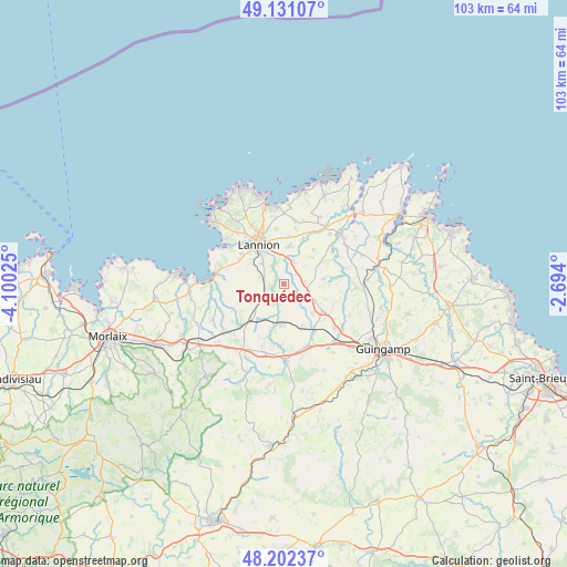
Tonquédec GPS coordinates[2]
48° 40' 7.896" North, 3° 23' 49.632" West
| Map corner | latitude | longitude |
|---|---|---|
| Upper-left | 49.13107°, | -4.10025° |
| Center: | 48.66886°, | -3.39712° |
| Lower-right: | 48.20237°, | -2.694° |
| Map W x H: | 103.3×103.3 km | = 64.2×64.2mi |
| max Lat: | 51.07786° ⇑27.5% North |
| Tonquédec: | 48.66886° |
| min Lat: | ⇓72.5% South 41.3874° |
| min Long | Tonquédec | max Long |
| -5.08615° | -3.39712° | 9.52242° |
| W 1.9%⇐ | ⇒98.1% E |
Elevation
Elevation of Tonquédec is 93 m = 305 ft, and this is 100.7 m = 330 ft below average elevation for this country.
| Max E: |
2333 m = 7654 ft | 63.6% |
| Avg. | 193.7 m = 635 ft | |
| Tonquédec | 93 m = 305 ft | |
Min E: |
-1 m = -3 ft | 36.4% |
See also: France elevation on elevation.city.
Geographical zone
Tonquédec is located in North temperate zone (between Tropic of Cancer and the Arctic Circle). Distance of this North polar circle is 1989.7 km =1236.3 mi to North.| Distance of | km | miles | from Tonquédec |
|---|---|---|---|
| North Pole | 4595.6 | 2855.6 | to North |
| Arctic Circle | 1989.7 | 1236.3 | to North |
| Tropic Cancer | 2805.6 | 1743.3 | to South |
| Equator | 5411.5 | 3362.5 | to South |


Nearby cities:
15 places around Tonquédec: (largest is in red/bold)
• Bégard
8.4 km =5.2 mi,  122°
122°
• Caouënnec-Lanvézéac
4.1 km =2.5 mi,  32°
32°
• Cavan
3.8 km =2.4 mi,  83°
83°
• Kermaria-Sulard
11.7 km =7.3 mi,  9°
9°
• Lannion
8.3 km =5.2 mi,  328°
328°
• Lanvellec
11.7 km =7.3 mi,  242°
242°
• Le Vieux-Marché
8.6 km =5.3 mi,  206°
206°
• Plouaret
7.7 km =4.8 mi,  221°
221°
• Ploubezre
5.2 km =3.2 mi,  311°
311°
• Ploumilliau
8.9 km =5.5 mi,  280°
280°
• Plounévez-Moëdec
12 km =7.5 mi,  198°
198°
• Pluzunet
3.7 km =2.3 mi,  148°
148°
• Prat
7.4 km =4.6 mi, 83°
• Pédernec
12.3 km =7.6 mi,  130°
130°
• Rospez
6.8 km =4.2 mi, 8°
Sources, notices
• [Note1] Compared only with cities in France existing in our database
• [Src1] Map data: © OpenStreetMap contributors (CC-BY-SA)
• [Src2] Other city data from geonames.org with taken over terms of usage.
• [Src3] Geographical zone / Annual Mean Temperature by Robert A. Rohde @ Wikipedia
