Pleudaniel geodata
Pleudaniel (Brittany) is a populated place; located in France in Europe/Paris (GMT+2) time zone. With population of 1,041 people, there are 8531 cities with bigger population in this country. Compared to other cities in France, 74.7% of cities are located further ↓South; 97.6% of cities are located further →East and 83.4% of cities have higher elevation than Pleudaniel. Note1
Administrative division(s):
- Level 1: Brittany
- Level 2: Département des Côtes-d’Armor
- Level 3: Arrondissement de Lannion
- Level 4: Pleudaniel


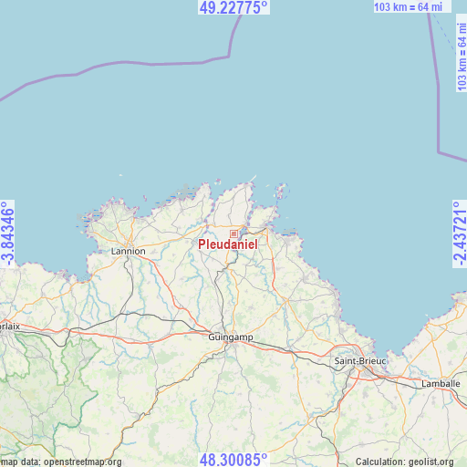
Pleudaniel GPS coordinates[2]
48° 45' 59.184" North, 3° 8' 25.188" West
| Map corner | latitude | longitude |
|---|---|---|
| Upper-left | 49.22775°, | -3.84346° |
| Center: | 48.76644°, | -3.14033° |
| Lower-right: | 48.30085°, | -2.43721° |
| Map W x H: | 103.1×103.1 km | = 64.1×64.1mi |
| max Lat: | 51.07786° ⇑25.3% North |
| Pleudaniel: | 48.76644° |
| min Lat: | ⇓74.7% South 41.3874° |
| min Long | Pleudaniel | max Long |
| -5.08615° | -3.14033° | 9.52242° |
| W 2.4%⇐ | ⇒97.6% E |
Elevation
Elevation of Pleudaniel is 46 m = 151 ft, and this is 147.7 m = 485 ft below average elevation for this country.
| Max E: |
2333 m = 7654 ft | 83.4% |
| Avg. | 193.7 m = 635 ft | |
| Pleudaniel | 46 m = 151 ft | |
Min E: |
-1 m = -3 ft | 16.6% |
See also: France elevation on elevation.city.
Geographical zone
Pleudaniel is located in North temperate zone (between Tropic of Cancer and the Arctic Circle). Distance of this North polar circle is 1978.9 km =1229.6 mi to North.| Distance of | km | miles | from Pleudaniel |
|---|---|---|---|
| North Pole | 4584.7 | 2848.8 | to North |
| Arctic Circle | 1978.9 | 1229.6 | to North |
| Tropic Cancer | 2816.4 | 1750 | to South |
| Equator | 5422.3 | 3369.3 | to South |


Nearby cities:
15 places around Pleudaniel: (largest is in red/bold)
• Lézardrieux
3.3 km =2.1 mi,  50°
50°
• Minihy-Tréguier
6.6 km =4.1 mi,  280°
280°
• Paimpol
7.2 km =4.5 mi,  79°
79°
• Pleubian
8.5 km =5.3 mi,  0°
0°
• Pleumeur-Gautier
3.9 km =2.4 mi,  343°
343°
• Ploubazlanec
8.7 km =5.4 mi,  64°
64°
• Plouguiel
8 km =5 mi,  295°
295°
• Plourivo
5.6 km =3.5 mi,  114°
114°
• Ploëzal
7.3 km =4.5 mi,  219°
219°
• Pommerit-Jaudy
8.5 km =5.3 mi,  241°
241°
• Pontrieux
7.4 km =4.6 mi,  191°
191°
• Quemper-Guézennec
7.4 km =4.6 mi,  159°
159°
• Trédarzec
4.9 km =3 mi, 295°
• Tréguier
7.1 km =4.4 mi,  285°
285°
• Yvias
8.7 km =5.4 mi,  131°
131°
Sources, notices
• [Note1] Compared only with cities in France existing in our database
• [Src1] Map data: © OpenStreetMap contributors (CC-BY-SA)
• [Src2] Other city data from geonames.org with taken over terms of usage.
• [Src3] Geographical zone / Annual Mean Temperature by Robert A. Rohde @ Wikipedia
