Pommerit-Jaudy geodata
Pommerit-Jaudy (Brittany) is a populated place; located in France in Europe/Paris (GMT+2) time zone. With population of 1,187 people, there are 7613 cities with bigger population in this country. Compared to other cities in France, 73.9% of cities are located further ↓South; 97.9% of cities are located further →East and 70.5% of cities have higher elevation than Pommerit-Jaudy. Note1
Administrative division(s):
- Level 1: Brittany
- Level 2: Département des Côtes-d’Armor
- Level 3: Arrondissement de Lannion
- Level 4: La Roche-Jaudy


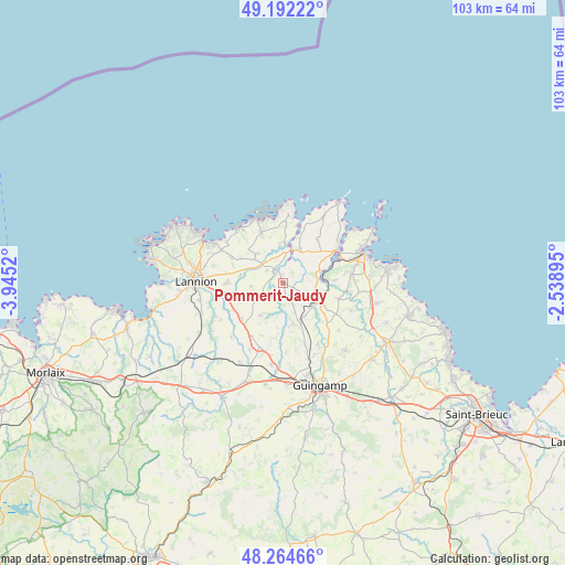
Pommerit-Jaudy GPS coordinates[2]
48° 43' 50.088" North, 3° 14' 31.488" West
| Map corner | latitude | longitude |
|---|---|---|
| Upper-left | 49.19222°, | -3.9452° |
| Center: | 48.73058°, | -3.24208° |
| Lower-right: | 48.26466°, | -2.53895° |
| Map W x H: | 103.1×103.1 km | = 64.1×64.1mi |
| max Lat: | 51.07786° ⇑26.1% North |
| Pommerit-Jaudy: | 48.73058° |
| min Lat: | ⇓73.9% South 41.3874° |
| min Long | Pommerit-Jaudy | max Long |
| -5.08615° | -3.24208° | 9.52242° |
| W 2.1%⇐ | ⇒97.9% E |
Elevation
Elevation of Pommerit-Jaudy is 77 m = 253 ft, and this is 116.7 m = 383 ft below average elevation for this country.
| Max E: |
2333 m = 7654 ft | 70.5% |
| Avg. | 193.7 m = 635 ft | |
| Pommerit-Jaudy | 77 m = 253 ft | |
Min E: |
-1 m = -3 ft | 29.5% |
See also: France elevation on elevation.city.
Geographical zone
Pommerit-Jaudy is located in North temperate zone (between Tropic of Cancer and the Arctic Circle). Distance of this North polar circle is 1982.8 km =1232.1 mi to North.| Distance of | km | miles | from Pommerit-Jaudy |
|---|---|---|---|
| North Pole | 4588.7 | 2851.3 | to North |
| Arctic Circle | 1982.8 | 1232.1 | to North |
| Tropic Cancer | 2812.4 | 1747.5 | to South |
| Equator | 5418.3 | 3366.8 | to South |


Nearby cities:
15 places around Pommerit-Jaudy: (largest is in red/bold)
• Camlez
7 km =4.3 mi,  319°
319°
• Caouënnec-Lanvézéac
9.8 km =6.1 mi,  249°
249°
• La Roche-Derrien
2.2 km =1.4 mi, 320°
• Langoat
3.6 km =2.2 mi,  307°
307°
• Minihy-Tréguier
5.3 km =3.3 mi,  10°
10°
• Penvénan
9.8 km =6.1 mi,  336°
336°
• Pleudaniel
8.5 km =5.3 mi,  61°
61°
• Pleumeur-Gautier
10 km =6.2 mi,  39°
39°
• Plouguiel
7.4 km =4.6 mi,  1°
1°
• Plouëc-du-Trieux
6.1 km =3.8 mi,  149°
149°
• Ploëzal
3.3 km =2.1 mi,  120°
120°
• Pontrieux
6.9 km =4.3 mi, 118°
• Prat
7.2 km =4.5 mi,  213°
213°
• Trédarzec
6.8 km =4.2 mi,  26°
26°
• Tréguier
5.9 km =3.7 mi, 6°
Sources, notices
• [Note1] Compared only with cities in France existing in our database
• [Src1] Map data: © OpenStreetMap contributors (CC-BY-SA)
• [Src2] Other city data from geonames.org with taken over terms of usage.
• [Src3] Geographical zone / Annual Mean Temperature by Robert A. Rohde @ Wikipedia
