Plestin-les-Grèves geodata
Plestin-les-Grèves (Brittany) is a populated place; located in France in Europe/Paris (GMT+2) time zone. With population of 3,700 people, there are 2659 cities with bigger population in this country. Compared to other cities in France, 72.2% of cities are located further ↓South; 98.5% of cities are located further →East and 83.1% of cities have higher elevation than Plestin-les-Grèves. Note1
Administrative division(s):
- Level 1: Brittany
- Level 2: Département des Côtes-d’Armor
- Level 3: Arrondissement de Lannion
- Level 4: Plestin-les-Grèves


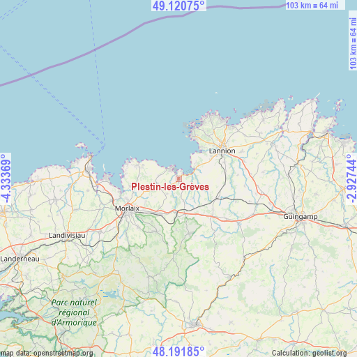
Plestin-les-Grèves GPS coordinates[2]
48° 39' 30.384" North, 3° 37' 50.016" West
| Map corner | latitude | longitude |
|---|---|---|
| Upper-left | 49.12075°, | -4.33369° |
| Center: | 48.65844°, | -3.63056° |
| Lower-right: | 48.19185°, | -2.92744° |
| Map W x H: | 103.3×103.3 km | = 64.2×64.2mi |
| max Lat: | 51.07786° ⇑27.8% North |
| Plestin-les-Grèves: | 48.65844° |
| min Lat: | ⇓72.2% South 41.3874° |
| min Long | Plestin-les-Gr� | max Long |
| -5.08615° | -3.63056° | 9.52242° |
| W 1.5%⇐ | ⇒98.5% E |
Elevation
Elevation of Plestin-les-Grèves is 47 m = 154 ft, and this is 146.7 m = 481 ft below average elevation for this country.
| Max E: |
2333 m = 7654 ft | 83.1% |
| Avg. | 193.7 m = 635 ft | |
| Plestin-les-Grèves | 47 m = 154 ft | |
Min E: |
-1 m = -3 ft | 16.9% |
See also: France elevation on elevation.city.
Geographical zone
Plestin-les-Grèves is located in North temperate zone (between Tropic of Cancer and the Arctic Circle). Distance of this North polar circle is 1990.9 km =1237.1 mi to North.| Distance of | km | miles | from Plestin-les-Grèves |
|---|---|---|---|
| North Pole | 4596.8 | 2856.3 | to North |
| Arctic Circle | 1990.9 | 1237.1 | to North |
| Tropic Cancer | 2804.4 | 1742.6 | to South |
| Equator | 5410.3 | 3361.8 | to South |


Nearby cities:
15 places around Plestin-les-Grèves: (largest is in red/bold)
• Garlan
11.2 km =7 mi,  235°
235°
• Guimaëc
5.8 km =3.6 mi,  279°
279°
• Lanmeur
6.4 km =4 mi,  258°
258°
• Lanvellec
8.1 km =5 mi,  122°
122°
• Locquirec
3.9 km =2.4 mi,  343°
343°
• Locquémeau
8.9 km =5.5 mi,  34°
34°
• Plouigneau
11.4 km =7.1 mi,  206°
206°
• Ploumilliau
8.8 km =5.5 mi,  71°
71°
• Plounérin
12.5 km =7.8 mi,  144°
144°
• Plouégat-Guérand
5.3 km =3.3 mi, 209°
• Plouégat-Moysan
10.3 km =6.4 mi,  174°
174°
• Plufur
8 km =5 mi, 144°
• Saint-Jean-du-Doigt
11 km =6.8 mi,  294°
294°
• Trébeurden
12.9 km =8 mi,  21°
21°
• Trédrez-Locquémeau
6.6 km =4.1 mi,  45°
45°
Sources, notices
• [Note1] Compared only with cities in France existing in our database
• [Src1] Map data: © OpenStreetMap contributors (CC-BY-SA)
• [Src2] Other city data from geonames.org with taken over terms of usage.
• [Src3] Geographical zone / Annual Mean Temperature by Robert A. Rohde @ Wikipedia
