Locquirec geodata
Locquirec (Brittany) is a populated place; located in France in Europe/Paris (GMT+2) time zone. With population of 1,367 people, there are 6735 cities with bigger population in this country. Compared to other cities in France, 73% of cities are located further ↓South; 98.6% of cities are located further →East and 97% of cities have higher elevation than Locquirec. Note1
Administrative division(s):
- Level 1: Brittany
- Level 2: Département du Finistère
- Level 3: Arrondissement de Morlaix
- Level 4: Locquirec


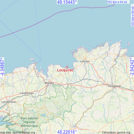
Locquirec GPS coordinates[2]
48° 41' 32.748" North, 3° 38' 43.944" West
| Map corner | latitude | longitude |
|---|---|---|
| Upper-left | 49.15443°, | -4.34867° |
| Center: | 48.69243°, | -3.64554° |
| Lower-right: | 48.22616°, | -2.94242° |
| Map W x H: | 103.2×103.2 km | = 64.1×64.1mi |
| max Lat: | 51.07786° ⇑27% North |
| Locquirec: | 48.69243° |
| min Lat: | ⇓73% South 41.3874° |
| min Long | Locquirec | max Long |
| -5.08615° | -3.64554° | 9.52242° |
| W 1.4%⇐ | ⇒98.6% E |
Elevation
Elevation of Locquirec is 11 m = 36 ft, and this is 182.7 m = 599 ft below average elevation for this country.
| Max E: |
2333 m = 7654 ft | 97% |
| Avg. | 193.7 m = 635 ft | |
| Locquirec | 11 m = 36 ft | |
Min E: |
-1 m = -3 ft | 3% |
See also: France elevation on elevation.city.
Geographical zone
Locquirec is located in North temperate zone (between Tropic of Cancer and the Arctic Circle). Distance of this North polar circle is 1987.1 km =1234.7 mi to North.| Distance of | km | miles | from Locquirec |
|---|---|---|---|
| North Pole | 4593 | 2854 | to North |
| Arctic Circle | 1987.1 | 1234.7 | to North |
| Tropic Cancer | 2808.2 | 1744.9 | to South |
| Equator | 5414.1 | 3364.2 | to South |


Nearby cities:
15 places around Locquirec: (largest is in red/bold)
• Garlan
12.9 km =8 mi,  218°
218°
• Guimaëc
5.4 km =3.4 mi,  238°
238°
• Lanmeur
7.2 km =4.5 mi,  226°
226°
• Lanvellec
11.3 km =7 mi,  135°
135°
• Locquémeau
7.1 km =4.4 mi,  59°
59°
• Plestin-les-Grèves
3.9 km =2.4 mi,  163°
163°
• Pleumeur-Bodou
12.5 km =7.8 mi,  48°
48°
• Plougasnou
11.4 km =7.1 mi,  274°
274°
• Ploumilliau
9.5 km =5.9 mi,  96°
96°
• Plouégat-Guérand
8.6 km =5.3 mi,  190°
190°
• Plouégat-Moysan
14.1 km =8.8 mi,  171°
171°
• Plufur
11.8 km =7.3 mi,  150°
150°
• Saint-Jean-du-Doigt
8.9 km =5.5 mi,  275°
275°
• Trébeurden
10.1 km =6.3 mi,  35°
35°
• Trédrez-Locquémeau
5.8 km =3.6 mi,  81°
81°
Sources, notices
• [Note1] Compared only with cities in France existing in our database
• [Src1] Map data: © OpenStreetMap contributors (CC-BY-SA)
• [Src2] Other city data from geonames.org with taken over terms of usage.
• [Src3] Geographical zone / Annual Mean Temperature by Robert A. Rohde @ Wikipedia
