Plérin geodata
Plérin (Brittany) is a populated place; located in France in Europe/Paris (GMT+2) time zone. With population of 13,860 people, there are 683 cities with bigger population in this country. Compared to other cities in France, 69.3% of cities are located further ↓South; 96.8% of cities are located further →East and 58.7% of cities have higher elevation than Plérin. Note1
Administrative division(s):
- Level 1: Brittany
- Level 2: Département des Côtes-d’Armor
- Level 3: Arrondissement de Saint-Brieuc
- Level 4: Plérin


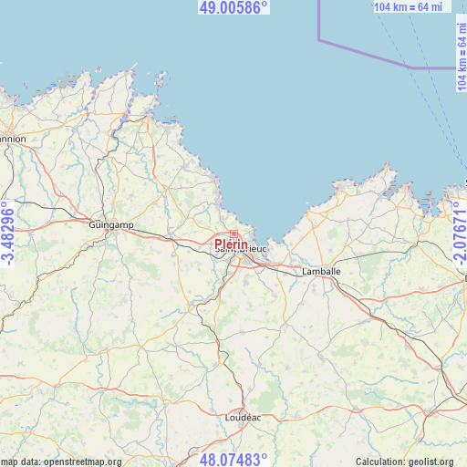
Plérin GPS coordinates[2]
48° 32' 32.964" North, 2° 46' 47.388" West
| Map corner | latitude | longitude |
|---|---|---|
| Upper-left | 49.00586°, | -3.48296° |
| Center: | 48.54249°, | -2.77983° |
| Lower-right: | 48.07483°, | -2.07671° |
| Map W x H: | 103.5×103.5 km | = 64.3×64.3mi |
| max Lat: | 51.07786° ⇑30.7% North |
| Plérin: | 48.54249° |
| min Lat: | ⇓69.3% South 41.3874° |
| min Long | Plérin | max Long |
| -5.08615° | -2.77983° | 9.52242° |
| W 3.2%⇐ | ⇒96.8% E |
Elevation
Elevation of Plérin is 106 m = 348 ft, and this is 87.7 m = 288 ft below average elevation for this country.
| Max E: |
2333 m = 7654 ft | 58.7% |
| Avg. | 193.7 m = 635 ft | |
| Plérin | 106 m = 348 ft | |
Min E: |
-1 m = -3 ft | 41.3% |
See also: France elevation on elevation.city.
Geographical zone
Plérin is located in North temperate zone (between Tropic of Cancer and the Arctic Circle). Distance of this North polar circle is 2003.8 km =1245.1 mi to North.| Distance of | km | miles | from Plérin |
|---|---|---|---|
| North Pole | 4609.6 | 2864.3 | to North |
| Arctic Circle | 2003.8 | 1245.1 | to North |
| Tropic Cancer | 2791.5 | 1734.6 | to South |
| Equator | 5397.4 | 3353.8 | to South |


Nearby cities:
15 places around Plérin: (largest is in red/bold)
• Binic
7.3 km =4.5 mi,  332°
332°
• Hillion
8.9 km =5.5 mi,  110°
110°
• La Méaugon
6.5 km =4 mi,  221°
221°
• Langueux
6.9 km =4.3 mi,  139°
139°
• Lantic
10.3 km =6.4 mi,  313°
313°
• Plerneuf
8.2 km =5.1 mi,  248°
248°
• Ploufragan
5.8 km =3.6 mi,  190°
190°
• Plouvara
10.7 km =6.6 mi, 249°
• Pordic
4.2 km =2.6 mi,  318°
318°
• Saint-Brieuc
3.2 km =2 mi,  164°
164°
• Saint-Julien
10.4 km =6.5 mi, 193°
• Trégomeur
8.1 km =5 mi,  289°
289°
• Trémuson
5.5 km =3.4 mi, 247°
• Yffiniac
10 km =6.2 mi,  130°
130°
• Étables-sur-Mer
10.8 km =6.7 mi,  338°
338°
Sources, notices
• [Note1] Compared only with cities in France existing in our database
• [Src1] Map data: © OpenStreetMap contributors (CC-BY-SA)
• [Src2] Other city data from geonames.org with taken over terms of usage.
• [Src3] Geographical zone / Annual Mean Temperature by Robert A. Rohde @ Wikipedia
