Pierrefonds geodata
Pierrefonds (Hauts-de-France) is a populated place; located in France in Europe/Paris (GMT+2) time zone. With population of 2,217 people, there are 4335 cities with bigger population in this country. Compared to other cities in France, 87% of cities are located further ↓South; 57.5% of cities are located further ←West and 67.4% of cities have higher elevation than Pierrefonds. Note1
Administrative division(s):
- Level 1: Hauts-de-France
- Level 2: Département de l'Oise
- Level 3: Arrondissement de Compiègne
- Level 4: Pierrefonds


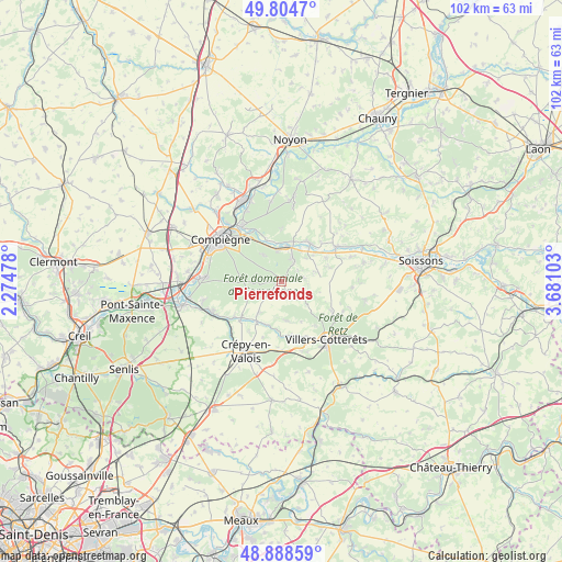
Pierrefonds GPS coordinates[2]
49° 20' 55.608" North, 2° 58' 40.44" East
| Map corner | latitude | longitude |
|---|---|---|
| Upper-left | 49.8047°, | 2.27478° |
| Center: | 49.34878°, | 2.9779° |
| Lower-right: | 48.88859°, | 3.68103° |
| Map W x H: | 101.9×101.9 km | = 63.3×63.3mi |
| max Lat: | 51.07786° ⇑13% North |
| Pierrefonds: | 49.34878° |
| min Lat: | ⇓87% South 41.3874° |
| min Long | Pierrefonds | max Long |
| -5.08615° | 2.9779° | 9.52242° |
| W 57.5%⇐ | ⇒42.5% E |
Elevation
Elevation of Pierrefonds is 84 m = 276 ft, and this is 109.7 m = 360 ft below average elevation for this country.
| Max E: |
2333 m = 7654 ft | 67.4% |
| Avg. | 193.7 m = 635 ft | |
| Pierrefonds | 84 m = 276 ft | |
Min E: |
-1 m = -3 ft | 32.6% |
See also: France elevation on elevation.city.
Geographical zone
Pierrefonds is located in North temperate zone (between Tropic of Cancer and the Arctic Circle). Distance of this North polar circle is 1914.1 km =1189.4 mi to North.| Distance of | km | miles | from Pierrefonds |
|---|---|---|---|
| North Pole | 4520 | 2808.6 | to North |
| Arctic Circle | 1914.1 | 1189.4 | to North |
| Tropic Cancer | 2881.2 | 1790.3 | to South |
| Equator | 5487.1 | 3409.5 | to South |


Nearby cities:
15 places around Pierrefonds: (largest is in red/bold)
• Attichy
8.7 km =5.4 mi,  36°
36°
• Berneuil-sur-Aisne
7.7 km =4.8 mi,  17°
17°
• Bonneuil-en-Valois
7.2 km =4.5 mi,  171°
171°
• Couloisy
6.7 km =4.2 mi,  32°
32°
• Cuise-la-Motte
4.6 km =2.9 mi, 25°
• Fresnoy-la-Rivière
8.3 km =5.2 mi,  212°
212°
• Gilocourt
9.5 km =5.9 mi,  228°
228°
• Haramont
9.9 km =6.2 mi,  142°
142°
• Jaulzy
8.2 km =5.1 mi,  50°
50°
• Montigny-Lengrain
9.1 km =5.7 mi,  73°
73°
• Morienval
7 km =4.3 mi,  216°
216°
• Orrouy
10.8 km =6.7 mi, 233°
• Rethondes
8 km =5 mi,  339°
339°
• Trosly-Breuil
5.8 km =3.6 mi,  351°
351°
• Vieux-Moulin
5.9 km =3.7 mi,  326°
326°
Sources, notices
• [Note1] Compared only with cities in France existing in our database
• [Src1] Map data: © OpenStreetMap contributors (CC-BY-SA)
• [Src2] Other city data from geonames.org with taken over terms of usage.
• [Src3] Geographical zone / Annual Mean Temperature by Robert A. Rohde @ Wikipedia
