Cuise-la-Motte geodata
Cuise-la-Motte (Hauts-de-France) is a populated place; located in France in Europe/Paris (GMT+2) time zone. With population of 2,478 people, there are 3920 cities with bigger population in this country. Compared to other cities in France, 87.7% of cities are located further ↓South; 57.9% of cities are located further ←West and 82.6% of cities have higher elevation than Cuise-la-Motte. Note1
Administrative division(s):
- Level 1: Hauts-de-France
- Level 2: Département de l'Oise
- Level 3: Arrondissement de Compiègne
- Level 4: Cuise-la-Motte


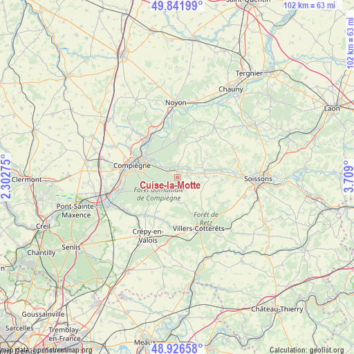
Cuise-la-Motte GPS coordinates[2]
49° 23' 11.112" North, 3° 0' 21.168" East
| Map corner | latitude | longitude |
|---|---|---|
| Upper-left | 49.84199°, | 2.30275° |
| Center: | 49.38642°, | 3.00588° |
| Lower-right: | 48.92658°, | 3.709° |
| Map W x H: | 101.8×101.8 km | = 63.3×63.3mi |
| max Lat: | 51.07786° ⇑12.3% North |
| Cuise-la-Motte: | 49.38642° |
| min Lat: | ⇓87.7% South 41.3874° |
| min Long | Cuise-la-Motte | max Long |
| -5.08615° | 3.00588° | 9.52242° |
| W 57.9%⇐ | ⇒42.1% E |
Elevation
Elevation of Cuise-la-Motte is 48 m = 157 ft, and this is 145.7 m = 478 ft below average elevation for this country.
| Max E: |
2333 m = 7654 ft | 82.6% |
| Avg. | 193.7 m = 635 ft | |
| Cuise-la-Motte | 48 m = 157 ft | |
Min E: |
-1 m = -3 ft | 17.4% |
See also: France elevation on elevation.city.
Geographical zone
Cuise-la-Motte is located in North temperate zone (between Tropic of Cancer and the Arctic Circle). Distance of this North polar circle is 1909.9 km =1186.8 mi to North.| Distance of | km | miles | from Cuise-la-Motte |
|---|---|---|---|
| North Pole | 4515.8 | 2806 | to North |
| Arctic Circle | 1909.9 | 1186.8 | to North |
| Tropic Cancer | 2885.3 | 1792.8 | to South |
| Equator | 5491.3 | 3412.1 | to South |


Nearby cities:
15 places around Cuise-la-Motte: (largest is in red/bold)
• Attichy
4.2 km =2.6 mi,  48°
48°
• Autrêches
10.8 km =6.7 mi, 53°
• Berneuil-sur-Aisne
3.2 km =2 mi,  4°
4°
• Berny-Rivière
10 km =6.2 mi,  76°
76°
• Choisy-au-Bac
10.9 km =6.8 mi,  301°
301°
• Couloisy
2.1 km =1.3 mi, 46°
• Jaulzy
4.4 km =2.7 mi, 76°
• Montigny-Lengrain
6.9 km =4.3 mi,  103°
103°
• Pierrefonds
4.6 km =2.9 mi,  205°
205°
• Ressons-le-Long
10.4 km =6.5 mi,  89°
89°
• Rethondes
5.8 km =3.6 mi, 304°
• Tracy-le-Mont
9.5 km =5.9 mi, 1°
• Trosly-Breuil
3.2 km =2 mi, 298°
• Vic-sur-Aisne
8 km =5 mi,  74°
74°
• Vieux-Moulin
5.4 km =3.4 mi,  277°
277°
Sources, notices
• [Note1] Compared only with cities in France existing in our database
• [Src1] Map data: © OpenStreetMap contributors (CC-BY-SA)
• [Src2] Other city data from geonames.org with taken over terms of usage.
• [Src3] Geographical zone / Annual Mean Temperature by Robert A. Rohde @ Wikipedia
