Fresnoy-la-Rivière geodata
Fresnoy-la-Rivière (Hauts-de-France) is a populated place; located in France in Europe/Paris (GMT+2) time zone. With population of 660 people, there are 12381 cities with bigger population in this country. Compared to other cities in France, 85.8% of cities are located further ↓South; 56.6% of cities are located further ←West and 77.3% of cities have higher elevation than Fresnoy-la-Rivière. Note1
Administrative division(s):
- Level 1: Hauts-de-France
- Level 2: Département de l'Oise
- Level 3: Arrondissement de Senlis
- Level 4: Fresnoy-la-Rivière


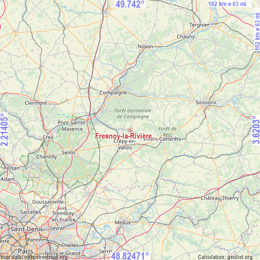
Fresnoy-la-Rivière GPS coordinates[2]
49° 17' 7.764" North, 2° 55' 1.812" East
| Map corner | latitude | longitude |
|---|---|---|
| Upper-left | 49.742°, | 2.21405° |
| Center: | 49.28549°, | 2.91717° |
| Lower-right: | 48.82471°, | 3.6203° |
| Map W x H: | 102×102 km | = 63.4×63.4mi |
| max Lat: | 51.07786° ⇑14.2% North |
| Fresnoy-la-Rivière: | 49.28549° |
| min Lat: | ⇓85.8% South 41.3874° |
| min Long | Fresnoy-la-Rivi | max Long |
| -5.08615° | 2.91717° | 9.52242° |
| W 56.6%⇐ | ⇒43.4% E |
Elevation
Elevation of Fresnoy-la-Rivière is 61 m = 200 ft, and this is 132.7 m = 435 ft below average elevation for this country.
| Max E: |
2333 m = 7654 ft | 77.3% |
| Avg. | 193.7 m = 635 ft | |
| Fresnoy-la-Rivière | 61 m = 200 ft | |
Min E: |
-1 m = -3 ft | 22.7% |
See also: France elevation on elevation.city.
Geographical zone
Fresnoy-la-Rivière is located in North temperate zone (between Tropic of Cancer and the Arctic Circle). Distance of this North polar circle is 1921.1 km =1193.7 mi to North.| Distance of | km | miles | from Fresnoy-la-Rivière |
|---|---|---|---|
| North Pole | 4527 | 2812.9 | to North |
| Arctic Circle | 1921.1 | 1193.7 | to North |
| Tropic Cancer | 2874.1 | 1785.9 | to South |
| Equator | 5480 | 3405.1 | to South |


Nearby cities:
15 places around Fresnoy-la-Rivière: (largest is in red/bold)
• Bonneuil-en-Valois
5.4 km =3.4 mi,  90°
90°
• Béthisy-Saint-Martin
7.3 km =4.5 mi,  278°
278°
• Béthisy-Saint-Pierre
9 km =5.6 mi, 283°
• Crépy-en-Valois
6.1 km =3.8 mi,  200°
200°
• Gilocourt
2.9 km =1.8 mi,  285°
285°
• Haramont
10.5 km =6.5 mi, 94°
• Lévignen
9.5 km =5.9 mi,  180°
180°
• Morienval
1.4 km =0.9 mi,  10°
10°
• Néry
10.1 km =6.3 mi,  267°
267°
• Orrouy
4.4 km =2.7 mi, 277°
• Pierrefonds
8.3 km =5.2 mi,  32°
32°
• Saint-Sauveur
10.4 km =6.5 mi, 290°
• Trumilly
9.7 km =6 mi,  240°
240°
• Vauciennes
9.9 km =6.2 mi,  124°
124°
• Vaumoise
7.2 km =4.5 mi,  140°
140°
Sources, notices
• [Note1] Compared only with cities in France existing in our database
• [Src1] Map data: © OpenStreetMap contributors (CC-BY-SA)
• [Src2] Other city data from geonames.org with taken over terms of usage.
• [Src3] Geographical zone / Annual Mean Temperature by Robert A. Rohde @ Wikipedia
