Phalsbourg geodata
Phalsbourg (Grand Est) is a populated place; located in France in Europe/Paris (GMT+2) time zone. With population of 4,663 people, there are 2118 cities with bigger population in this country. Compared to other cities in France, 74.8% of cities are located further ↓South; 96.2% of cities are located further ←West and 83.6% of cities have lower elevation than Phalsbourg. Note1
Administrative division(s):
- Level 1: Grand Est
- Level 2: Moselle
- Level 3: Arrondissement de Sarrebourg-Château-Salins
- Level 4: Phalsbourg


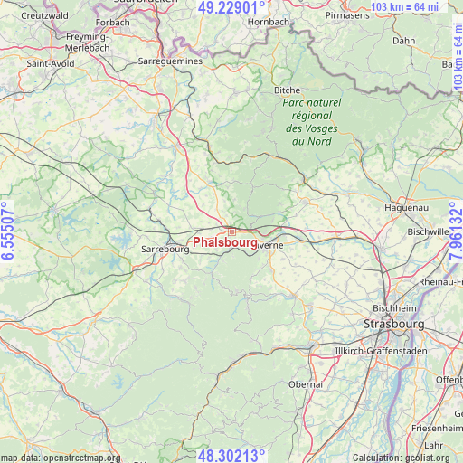
Phalsbourg GPS coordinates[2]
48° 46' 3.756" North, 7° 15' 29.52" East
| Map corner | latitude | longitude |
|---|---|---|
| Upper-left | 49.22901°, | 6.55507° |
| Center: | 48.76771°, | 7.2582° |
| Lower-right: | 48.30213°, | 7.96132° |
| Map W x H: | 103.1×103.1 km | = 64.1×64.1mi |
| max Lat: | 51.07786° ⇑25.2% North |
| Phalsbourg: | 48.76771° |
| min Lat: | ⇓74.8% South 41.3874° |
| min Long | Phalsbourg | max Long |
| -5.08615° | 7.2582° | 9.52242° |
| W 96.2%⇐ | ⇒3.8% E |
Elevation
Elevation of Phalsbourg is 329 m = 1079 ft, and this is 135.3 m = 444 ft above average elevation for this country.
| Max E: |
2333 m = 7654 ft | 16.4% |
| Phalsbourg | 329 m 1079 ft | |
| Avg. | 193.7 m = 635 ft | |
Min E: |
-1 m = -3 ft | 83.6% |
See also: France elevation on elevation.city.
Geographical zone
Phalsbourg is located in North temperate zone (between Tropic of Cancer and the Arctic Circle). Distance of this North polar circle is 1978.7 km =1229.5 mi to North.| Distance of | km | miles | from Phalsbourg |
|---|---|---|---|
| North Pole | 4584.6 | 2848.7 | to North |
| Arctic Circle | 1978.7 | 1229.5 | to North |
| Tropic Cancer | 2816.5 | 1750.1 | to South |
| Equator | 5422.5 | 3369.4 | to South |


Nearby cities:
15 places around Phalsbourg: (largest is in red/bold)
• Arzviller
8.8 km =5.5 mi,  231°
231°
• Danne
2.7 km =1.7 mi,  99°
99°
• Eschbourg
5.8 km =3.6 mi,  28°
28°
• Haegen
8.3 km =5.2 mi,  134°
134°
• Henridorff
5.1 km =3.2 mi,  222°
222°
• Hommarting
9 km =5.6 mi,  248°
248°
• Lixheim
8.6 km =5.3 mi,  275°
275°
• Lutzelbourg
3.5 km =2.2 mi,  185°
185°
• Mittelbronn
2.3 km =1.4 mi, 276°
• Monswiller
8.8 km =5.5 mi, 99°
• Ottersthal
6.9 km =4.3 mi, 102°
• Saint-Jean-Kourtzerode
4.9 km =3 mi,  255°
255°
• Saint-Jean-Saverne
7.6 km =4.7 mi,  87°
87°
• Saint-Louis
7.7 km =4.8 mi, 221°
• Saverne
8.2 km =5.1 mi,  110°
110°
Sources, notices
• [Note1] Compared only with cities in France existing in our database
• [Src1] Map data: © OpenStreetMap contributors (CC-BY-SA)
• [Src2] Other city data from geonames.org with taken over terms of usage.
• [Src3] Geographical zone / Annual Mean Temperature by Robert A. Rohde @ Wikipedia
