Lixheim geodata
Lixheim (Grand Est) is a populated place; located in France in Europe/Paris (GMT+2) time zone. With population of 589 people, there are 13496 cities with bigger population in this country. Compared to other cities in France, 75% of cities are located further ↓South; 95.4% of cities are located further ←West and 78.9% of cities have lower elevation than Lixheim. Note1
Administrative division(s):
- Level 1: Grand Est
- Level 2: Moselle
- Level 3: Arrondissement de Sarrebourg-Château-Salins
- Level 4: Lixheim


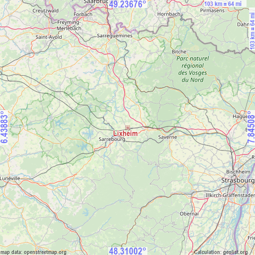
Lixheim GPS coordinates[2]
48° 46' 31.908" North, 7° 8' 31.02" East
| Map corner | latitude | longitude |
|---|---|---|
| Upper-left | 49.23676°, | 6.43883° |
| Center: | 48.77553°, | 7.14195° |
| Lower-right: | 48.31002°, | 7.84508° |
| Map W x H: | 103×103 km | = 64×64mi |
| max Lat: | 51.07786° ⇑25% North |
| Lixheim: | 48.77553° |
| min Lat: | ⇓75% South 41.3874° |
| min Long | Lixheim | max Long |
| -5.08615° | 7.14195° | 9.52242° |
| W 95.4%⇐ | ⇒4.6% E |
Elevation
Elevation of Lixheim is 280 m = 919 ft, and this is 86.3 m = 283 ft above average elevation for this country.
| Max E: |
2333 m = 7654 ft | 21.1% |
| Lixheim | 280 m 919 ft | |
| Avg. | 193.7 m = 635 ft | |
Min E: |
-1 m = -3 ft | 78.9% |
See also: France elevation on elevation.city.
Geographical zone
Lixheim is located in North temperate zone (between Tropic of Cancer and the Arctic Circle). Distance of this North polar circle is 1977.8 km =1228.9 mi to North.| Distance of | km | miles | from Lixheim |
|---|---|---|---|
| North Pole | 4583.7 | 2848.2 | to North |
| Arctic Circle | 1977.8 | 1228.9 | to North |
| Tropic Cancer | 2817.4 | 1750.7 | to South |
| Equator | 5423.3 | 3369.9 | to South |


Nearby cities:
15 places around Lixheim: (largest is in red/bold)
• Arzviller
6.6 km =4.1 mi,  165°
165°
• Brouderdorff
9.2 km =5.7 mi,  198°
198°
• Henridorff
6.9 km =4.3 mi,  132°
132°
• Hilbesheim
3.2 km =2 mi,  272°
272°
• Hommarting
4.1 km =2.5 mi,  177°
177°
• Lutzelbourg
9.3 km =5.8 mi,  118°
118°
• Mittelbronn
6.2 km =3.9 mi,  95°
95°
• Niderviller
7.4 km =4.6 mi, 200°
• Phalsbourg
8.6 km =5.3 mi, 95°
• Réding
3.7 km =2.3 mi,  223°
223°
• Saint-Jean-Kourtzerode
4.3 km =2.7 mi, 119°
• Saint-Louis
7.4 km =4.6 mi,  152°
152°
• Sarraltroff
6 km =3.7 mi, 270°
• Sarrebourg
7.6 km =4.7 mi,  234°
234°
• Weyer
8.9 km =5.5 mi,  8°
8°
Sources, notices
• [Note1] Compared only with cities in France existing in our database
• [Src1] Map data: © OpenStreetMap contributors (CC-BY-SA)
• [Src2] Other city data from geonames.org with taken over terms of usage.
• [Src3] Geographical zone / Annual Mean Temperature by Robert A. Rohde @ Wikipedia
