Henridorff geodata
Henridorff (Grand Est) is a populated place; located in France in Europe/Paris (GMT+2) time zone. With population of 547 people, there are 14264 cities with bigger population in this country. Compared to other cities in France, 74% of cities are located further ↓South; 95.8% of cities are located further ←West and 85.8% of cities have lower elevation than Henridorff. Note1
Administrative division(s):
- Level 1: Grand Est
- Level 2: Moselle
- Level 3: Arrondissement de Sarrebourg-Château-Salins
- Level 4: Henridorff


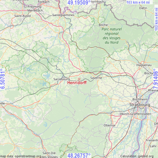
Henridorff GPS coordinates[2]
48° 44' 0.492" North, 7° 12' 39.384" East
| Map corner | latitude | longitude |
|---|---|---|
| Upper-left | 49.19509°, | 6.50781° |
| Center: | 48.73347°, | 7.21094° |
| Lower-right: | 48.26757°, | 7.91406° |
| Map W x H: | 103.1×103.1 km | = 64.1×64.1mi |
| max Lat: | 51.07786° ⇑26% North |
| Henridorff: | 48.73347° |
| min Lat: | ⇓74% South 41.3874° |
| min Long | Henridorff | max Long |
| -5.08615° | 7.21094° | 9.52242° |
| W 95.8%⇐ | ⇒4.2% E |
Elevation
Elevation of Henridorff is 359 m = 1178 ft, and this is 165.3 m = 542 ft above average elevation for this country.
| Max E: |
2333 m = 7654 ft | 14.2% |
| Henridorff | 359 m 1178 ft | |
| Avg. | 193.7 m = 635 ft | |
Min E: |
-1 m = -3 ft | 85.8% |
See also: France elevation on elevation.city.
Geographical zone
Henridorff is located in North temperate zone (between Tropic of Cancer and the Arctic Circle). Distance of this North polar circle is 1982.5 km =1231.9 mi to North.| Distance of | km | miles | from Henridorff |
|---|---|---|---|
| North Pole | 4588.4 | 2851.1 | to North |
| Arctic Circle | 1982.5 | 1231.9 | to North |
| Tropic Cancer | 2812.7 | 1747.7 | to South |
| Equator | 5418.7 | 3367 | to South |


Nearby cities:
15 places around Henridorff: (largest is in red/bold)
• Arzviller
3.8 km =2.4 mi,  243°
243°
• Brouderdorff
9 km =5.6 mi, 243°
• Dabo
9.1 km =5.7 mi,  168°
168°
• Danne
7 km =4.3 mi,  61°
61°
• Haegen
9.6 km =6 mi,  102°
102°
• Hommarting
4.9 km =3 mi,  276°
276°
• Lixheim
6.9 km =4.3 mi,  312°
312°
• Lutzelbourg
3.1 km =1.9 mi,  84°
84°
• Mittelbronn
4.2 km =2.6 mi,  15°
15°
• Niderviller
8 km =5 mi,  253°
253°
• Phalsbourg
5.1 km =3.2 mi,  42°
42°
• Plaine-de-Walsch
8.5 km =5.3 mi, 235°
• Réding
7.9 km =4.9 mi,  285°
285°
• Saint-Jean-Kourtzerode
2.9 km =1.8 mi,  333°
333°
• Saint-Louis
2.5 km =1.6 mi,  220°
220°
Sources, notices
• [Note1] Compared only with cities in France existing in our database
• [Src1] Map data: © OpenStreetMap contributors (CC-BY-SA)
• [Src2] Other city data from geonames.org with taken over terms of usage.
• [Src3] Geographical zone / Annual Mean Temperature by Robert A. Rohde @ Wikipedia
