Haegen geodata
Haegen (Grand Est) is a populated place; located in France in Europe/Paris (GMT+2) time zone. With population of 656 people, there are 12440 cities with bigger population in this country. Compared to other cities in France, 73.6% of cities are located further ↓South; 96.9% of cities are located further ←West and 78.5% of cities have lower elevation than Haegen. Note1
Administrative division(s):
- Level 1: Grand Est
- Level 2: Bas-Rhin
- Level 3: Arrondissement de Saverne
- Level 4: Haegen


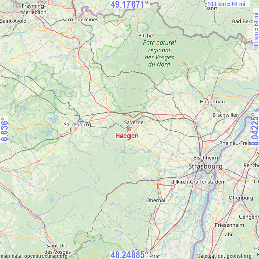
Haegen GPS coordinates[2]
48° 42' 53.712" North, 7° 20' 20.832" East
| Map corner | latitude | longitude |
|---|---|---|
| Upper-left | 49.17671°, | 6.636° |
| Center: | 48.71492°, | 7.33912° |
| Lower-right: | 48.24885°, | 8.04225° |
| Map W x H: | 103.2×103.2 km | = 64.1×64.1mi |
| max Lat: | 51.07786° ⇑26.4% North |
| Haegen: | 48.71492° |
| min Lat: | ⇓73.6% South 41.3874° |
| min Long | Haegen | max Long |
| -5.08615° | 7.33912° | 9.52242° |
| W 96.9%⇐ | ⇒3.1% E |
Elevation
Elevation of Haegen is 277 m = 909 ft, and this is 83.3 m = 273 ft above average elevation for this country.
| Max E: |
2333 m = 7654 ft | 21.5% |
| Haegen | 277 m 909 ft | |
| Avg. | 193.7 m = 635 ft | |
Min E: |
-1 m = -3 ft | 78.5% |
See also: France elevation on elevation.city.
Geographical zone
Haegen is located in North temperate zone (between Tropic of Cancer and the Arctic Circle). Distance of this North polar circle is 1984.6 km =1233.2 mi to North.| Distance of | km | miles | from Haegen |
|---|---|---|---|
| North Pole | 4590.5 | 2852.4 | to North |
| Arctic Circle | 1984.6 | 1233.2 | to North |
| Tropic Cancer | 2810.7 | 1746.5 | to South |
| Equator | 5416.6 | 3365.7 | to South |


Nearby cities:
15 places around Haegen: (largest is in red/bold)
• Danne
6.3 km =3.9 mi,  328°
328°
• Ernolsheim-lès-Saverne
9.1 km =5.7 mi,  19°
19°
• Lutzelbourg
6.7 km =4.2 mi,  290°
290°
• Marmoutier
4.2 km =2.6 mi,  131°
131°
• Monswiller
5.3 km =3.3 mi,  32°
32°
• Ottersthal
4.5 km =2.8 mi,  10°
10°
• Otterswiller
3.1 km =1.9 mi,  67°
67°
• Phalsbourg
8.3 km =5.2 mi,  314°
314°
• Romanswiller
9.2 km =5.7 mi,  146°
146°
• Saint-Jean-Saverne
6.4 km =4 mi, 15°
• Saverne
3.4 km =2.1 mi, 29°
• Schwenheim
5.4 km =3.4 mi,  91°
91°
• Steinbourg
8.2 km =5.1 mi,  41°
41°
• Thal-Marmoutier
1.7 km =1.1 mi,  144°
144°
• Waldolwisheim
7.5 km =4.7 mi, 74°
Sources, notices
• [Note1] Compared only with cities in France existing in our database
• [Src1] Map data: © OpenStreetMap contributors (CC-BY-SA)
• [Src2] Other city data from geonames.org with taken over terms of usage.
• [Src3] Geographical zone / Annual Mean Temperature by Robert A. Rohde @ Wikipedia
