Perrex geodata
Perrex (Auvergne-Rhône-Alpes) is a populated place; located in France in Europe/Paris (GMT+2) time zone. With population of 800 people, there are 10613 cities with bigger population in this country. Compared to other cities in France, 62.9% of cities are located further ↑North; 77.4% of cities are located further ←West and 67.2% of cities have lower elevation than Perrex. Note1
Administrative division(s):
- Level 1: Auvergne-Rhône-Alpes
- Level 2: Département de l'Ain
- Level 3: Arrondissement de Bourg-en-Bresse
- Level 4: Perrex


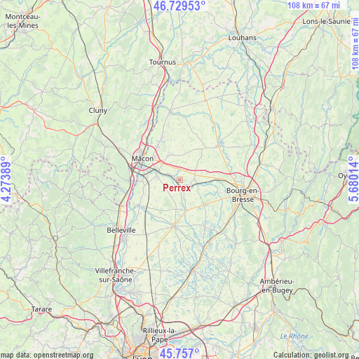
Perrex GPS coordinates[2]
46° 14' 43.512" North, 4° 58' 37.236" East
| Map corner | latitude | longitude |
|---|---|---|
| Upper-left | 46.72953°, | 4.27389° |
| Center: | 46.24542°, | 4.97701° |
| Lower-right: | 45.757°, | 5.68014° |
| Map W x H: | 108.1×108.1 km | = 67.2×67.2mi |
| max Lat: | 51.07786° ⇑62.9% North |
| Perrex: | 46.24542° |
| min Lat: | ⇓37.1% South 41.3874° |
| min Long | Perrex | max Long |
| -5.08615° | 4.97701° | 9.52242° |
| W 77.4%⇐ | ⇒22.6% E |
Elevation
Elevation of Perrex is 205 m = 673 ft, and this is 11.3 m = 37 ft above average elevation for this country.
| Max E: |
2333 m = 7654 ft | 32.8% |
| Perrex | 205 m 673 ft | |
| Avg. | 193.7 m = 635 ft | |
Min E: |
-1 m = -3 ft | 67.2% |
See also: France elevation on elevation.city.
Geographical zone
Perrex is located in North temperate zone (between Tropic of Cancer and the Arctic Circle). Distance of this North polar circle is 2259.2 km =1403.8 mi to North.| Distance of | km | miles | from Perrex |
|---|---|---|---|
| North Pole | 4865.1 | 3023 | to North |
| Arctic Circle | 2259.2 | 1403.8 | to North |
| Tropic Cancer | 2536.1 | 1575.9 | to South |
| Equator | 5142 | 3195.1 | to South |


Nearby cities:
15 places around Perrex: (largest is in red/bold)
• Biziat
4.1 km =2.5 mi,  219°
219°
• Bâgé-le-Châtel
7.9 km =4.9 mi,  333°
333°
• Chanoz-Châtenay
7.9 km =4.9 mi,  147°
147°
• Confrançon
7.2 km =4.5 mi,  71°
71°
• Crottet
7.2 km =4.5 mi,  298°
298°
• Cruzilles-lès-Mépillat
7.9 km =4.9 mi,  253°
253°
• Laiz
6.7 km =4.2 mi,  274°
274°
• Mézériat
5.4 km =3.4 mi,  99°
99°
• Pont-de-Veyle
7.2 km =4.5 mi,  284°
284°
• Saint-André-de-Bâgé
7.5 km =4.7 mi, 326°
• Saint-Cyr-sur-Menthon
3.3 km =2.1 mi,  353°
353°
• Saint-Jean-sur-Veyle
4.8 km =3 mi,  288°
288°
• Saint-Julien-sur-Veyle
5.2 km =3.2 mi,  197°
197°
• Sulignat
8.2 km =5.1 mi,  189°
189°
• Vonnas
3.3 km =2.1 mi,  159°
159°
Sources, notices
• [Note1] Compared only with cities in France existing in our database
• [Src1] Map data: © OpenStreetMap contributors (CC-BY-SA)
• [Src2] Other city data from geonames.org with taken over terms of usage.
• [Src3] Geographical zone / Annual Mean Temperature by Robert A. Rohde @ Wikipedia
