Pont-de-Veyle geodata
Pont-de-Veyle (Auvergne-Rhône-Alpes) is a populated place; located in France in Europe/Paris (GMT+2) time zone. With population of 1,696 people, there are 5531 cities with bigger population in this country. Compared to other cities in France, 62.8% of cities are located further ↑North; 76.3% of cities are located further ←West and 61.5% of cities have lower elevation than Pont-de-Veyle. Note1
Administrative division(s):
- Level 1: Auvergne-Rhône-Alpes
- Level 2: Département de l'Ain
- Level 3: Arrondissement de Bourg-en-Bresse
- Level 4: Pont-de-Veyle


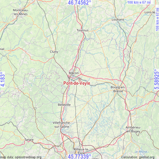
Pont-de-Veyle GPS coordinates[2]
46° 15' 41.976" North, 4° 53' 10.032" East
| Map corner | latitude | longitude |
|---|---|---|
| Upper-left | 46.74562°, | 4.183° |
| Center: | 46.26166°, | 4.88612° |
| Lower-right: | 45.77339°, | 5.58925° |
| Map W x H: | 108.1×108.1 km | = 67.2×67.2mi |
| max Lat: | 51.07786° ⇑62.8% North |
| Pont-de-Veyle: | 46.26166° |
| min Lat: | ⇓37.2% South 41.3874° |
| min Long | Pont-de-Veyle | max Long |
| -5.08615° | 4.88612° | 9.52242° |
| W 76.3%⇐ | ⇒23.7% E |
Elevation
Elevation of Pont-de-Veyle is 177 m = 581 ft, and this is 16.7 m = 55 ft below average elevation for this country.
| Max E: |
2333 m = 7654 ft | 38.5% |
| Avg. | 193.7 m = 635 ft | |
| Pont-de-Veyle | 177 m = 581 ft | |
Min E: |
-1 m = -3 ft | 61.5% |
See also: France elevation on elevation.city.
Geographical zone
Pont-de-Veyle is located in North temperate zone (between Tropic of Cancer and the Arctic Circle). Distance of this North polar circle is 2257.4 km =1402.7 mi to North.| Distance of | km | miles | from Pont-de-Veyle |
|---|---|---|---|
| North Pole | 4863.2 | 3021.9 | to North |
| Arctic Circle | 2257.4 | 1402.7 | to North |
| Tropic Cancer | 2537.9 | 1577 | to South |
| Equator | 5143.8 | 3196.2 | to South |


Nearby cities:
15 places around Pont-de-Veyle: (largest is in red/bold)
• Biziat
6.6 km =4.1 mi,  138°
138°
• Bâgé-la-Ville
7.3 km =4.5 mi,  35°
35°
• Bâgé-le-Châtel
6.4 km =4 mi,  33°
33°
• Cormoranche-sur-Saône
4.7 km =2.9 mi,  235°
235°
• Crottet
1.7 km =1.1 mi,  20°
20°
• Cruzilles-lès-Mépillat
4.1 km =2.5 mi,  187°
187°
• Garnerans
6.9 km =4.3 mi,  209°
209°
• Grièges
3 km =1.9 mi,  258°
258°
• Laiz
1.3 km =0.8 mi,  167°
167°
• Perrex
7.2 km =4.5 mi,  104°
104°
• Replonges
4.4 km =2.7 mi,  357°
357°
• Saint-André-de-Bâgé
5.3 km =3.3 mi, 33°
• Saint-Cyr-sur-Menthon
6.8 km =4.2 mi,  77°
77°
• Saint-Jean-sur-Veyle
2.4 km =1.5 mi, 97°
• Saint-Laurent-sur-Saône
6 km =3.7 mi,  324°
324°
Sources, notices
• [Note1] Compared only with cities in France existing in our database
• [Src1] Map data: © OpenStreetMap contributors (CC-BY-SA)
• [Src2] Other city data from geonames.org with taken over terms of usage.
• [Src3] Geographical zone / Annual Mean Temperature by Robert A. Rohde @ Wikipedia
