Pépieux geodata
Pépieux (Occitanie) is a populated place; located in France in Europe/Paris (GMT+2) time zone. With population of 1,072 people, there are 8316 cities with bigger population in this country. Compared to other cities in France, 95.7% of cities are located further ↑North; 53.1% of cities are located further ←West and 65.3% of cities have higher elevation than Pépieux. Note1
Administrative division(s):
- Level 1: Occitanie
- Level 2: Département de l'Aude
- Level 3: Arrondissement de Carcassonne
- Level 4: Pépieux


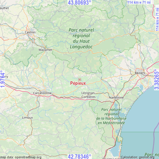
Pépieux GPS coordinates[2]
43° 17' 50.46" North, 2° 40' 46.272" East
| Map corner | latitude | longitude |
|---|---|---|
| Upper-left | 43.80693°, | 1.9764° |
| Center: | 43.29735°, | 2.67952° |
| Lower-right: | 42.78346°, | 3.38265° |
| Map W x H: | 113.8×113.8 km | = 70.7×70.7mi |
| max Lat: | 51.07786° ⇑95.7% North |
| Pépieux: | 43.29735° |
| min Lat: | ⇓4.3% South 41.3874° |
| min Long | Pépieux | max Long |
| -5.08615° | 2.67952° | 9.52242° |
| W 53.1%⇐ | ⇒46.9% E |
Elevation
Elevation of Pépieux is 89 m = 292 ft, and this is 104.7 m = 344 ft below average elevation for this country.
| Max E: |
2333 m = 7654 ft | 65.3% |
| Avg. | 193.7 m = 635 ft | |
| Pépieux | 89 m = 292 ft | |
Min E: |
-1 m = -3 ft | 34.7% |
See also: France elevation on elevation.city.
Geographical zone
Pépieux is located in North temperate zone (between Tropic of Cancer and the Arctic Circle). Distance of this Northern Tropic circle is 2208.3 km =1372.2 mi to South.| Distance of | km | miles | from Pépieux |
|---|---|---|---|
| North Pole | 5192.8 | 3226.7 | to North |
| Arctic Circle | 2587 | 1607.5 | to North |
| Tropic Cancer | 2208.3 | 1372.2 | to South |
| Equator | 4814.2 | 2991.4 | to South |


Nearby cities:
15 places around Pépieux: (largest is in red/bold)
• Azille
2.8 km =1.7 mi,  215°
215°
• Caunes-Minervois
12.9 km =8 mi,  284°
284°
• Conilhac-Corbières
12.4 km =7.7 mi,  166°
166°
• Douzens
14.1 km =8.8 mi,  207°
207°
• Homps
4.7 km =2.9 mi,  135°
135°
• La Livinière
4.1 km =2.5 mi,  300°
300°
• Laure-Minervois
13.2 km =8.2 mi,  257°
257°
• Lézignan-Corbières
12.9 km =8 mi,  149°
149°
• Moux
13.2 km =8.2 mi,  189°
189°
• Olonzac
4.5 km =2.8 mi,  111°
111°
• Peyriac-Minervois
9.2 km =5.7 mi,  265°
265°
• Puicheric
9.3 km =5.8 mi, 208°
• Rieux-Minervois
7.7 km =4.8 mi, 257°
• Sainte-Valière
13.4 km =8.3 mi,  101°
101°
• Siran
2.3 km =1.4 mi,  320°
320°
Sources, notices
• [Note1] Compared only with cities in France existing in our database
• [Src1] Map data: © OpenStreetMap contributors (CC-BY-SA)
• [Src2] Other city data from geonames.org with taken over terms of usage.
• [Src3] Geographical zone / Annual Mean Temperature by Robert A. Rohde @ Wikipedia
