Homps geodata
Homps (Occitanie) is a populated place; located in France in Europe/Paris (GMT+2) time zone. With population of 640 people, there are 12673 cities with bigger population in this country. Compared to other cities in France, 96.3% of cities are located further ↑North; 53.8% of cities are located further ←West and 81.5% of cities have higher elevation than Homps. Note1
Administrative division(s):
- Level 1: Occitanie
- Level 2: Département de l'Aude
- Level 3: Arrondissement de Narbonne
- Level 4: Homps


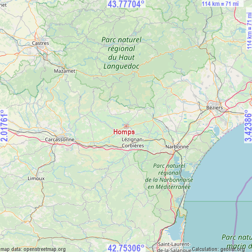
Homps GPS coordinates[2]
43° 16' 1.92" North, 2° 43' 14.664" East
| Map corner | latitude | longitude |
|---|---|---|
| Upper-left | 43.77704°, | 2.01761° |
| Center: | 43.2672°, | 2.72074° |
| Lower-right: | 42.75306°, | 3.42386° |
| Map W x H: | 113.9×113.9 km | = 70.8×70.8mi |
| max Lat: | 51.07786° ⇑96.3% North |
| Homps: | 43.2672° |
| min Lat: | ⇓3.7% South 41.3874° |
| min Long | Homps | max Long |
| -5.08615° | 2.72074° | 9.52242° |
| W 53.8%⇐ | ⇒46.2% E |
Elevation
Elevation of Homps is 51 m = 167 ft, and this is 142.7 m = 468 ft below average elevation for this country.
| Max E: |
2333 m = 7654 ft | 81.5% |
| Avg. | 193.7 m = 635 ft | |
| Homps | 51 m = 167 ft | |
Min E: |
-1 m = -3 ft | 18.5% |
See also: France elevation on elevation.city.
Geographical zone
Homps is located in North temperate zone (between Tropic of Cancer and the Arctic Circle). Distance of this Northern Tropic circle is 2204.9 km =1370.1 mi to South.| Distance of | km | miles | from Homps |
|---|---|---|---|
| North Pole | 5196.2 | 3228.8 | to North |
| Arctic Circle | 2590.3 | 1609.5 | to North |
| Tropic Cancer | 2204.9 | 1370.1 | to South |
| Equator | 4810.9 | 2989.4 | to South |


Nearby cities:
15 places around Homps: (largest is in red/bold)
• Azille
5 km =3.1 mi,  282°
282°
• Canet
11.2 km =7 mi,  113°
113°
• Conilhac-Corbières
8.8 km =5.5 mi,  182°
182°
• Ginestas
12.1 km =7.5 mi,  90°
90°
• La Livinière
8.7 km =5.4 mi,  308°
308°
• Luc-sur-Orbieu
11.3 km =7 mi,  152°
152°
• Lézignan-Corbières
8.4 km =5.2 mi,  156°
156°
• Moux
11.2 km =7 mi,  209°
209°
• Olonzac
1.9 km =1.2 mi,  25°
25°
• Puicheric
9.2 km =5.7 mi,  238°
238°
• Pépieux
4.7 km =2.9 mi,  315°
315°
• Rieux-Minervois
11 km =6.8 mi, 278°
• Sainte-Valière
9.8 km =6.1 mi, 86°
• Siran
7 km =4.3 mi, 316°
• Ventenac-en-Minervois
12 km =7.5 mi,  99°
99°
Sources, notices
• [Note1] Compared only with cities in France existing in our database
• [Src1] Map data: © OpenStreetMap contributors (CC-BY-SA)
• [Src2] Other city data from geonames.org with taken over terms of usage.
• [Src3] Geographical zone / Annual Mean Temperature by Robert A. Rohde @ Wikipedia
