Conilhac-Corbières geodata
Conilhac-Corbières (Occitanie) is a populated place; located in France in Europe/Paris (GMT+2) time zone. With population of 646 people, there are 12578 cities with bigger population in this country. Compared to other cities in France, 97.2% of cities are located further ↑North; 53.7% of cities are located further ←West and 69.7% of cities have higher elevation than Conilhac-Corbières. Note1
Administrative division(s):
- Level 1: Occitanie
- Level 2: Département de l'Aude
- Level 3: Arrondissement de Narbonne
- Level 4: Conilhac-Corbières


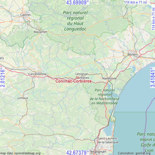
Conilhac-Corbières GPS coordinates[2]
43° 11' 18.924" North, 2° 42' 55.008" East
| Map corner | latitude | longitude |
|---|---|---|
| Upper-left | 43.69909°, | 2.01216° |
| Center: | 43.18859°, | 2.71528° |
| Lower-right: | 42.67379°, | 3.41841° |
| Map W x H: | 114×114 km | = 70.8×70.8mi |
| max Lat: | 51.07786° ⇑97.2% North |
| Conilhac-Corbières: | 43.18859° |
| min Lat: | ⇓2.8% South 41.3874° |
| min Long | Conilhac-Corbi� | max Long |
| -5.08615° | 2.71528° | 9.52242° |
| W 53.7%⇐ | ⇒46.3% E |
Elevation
Elevation of Conilhac-Corbières is 79 m = 259 ft, and this is 114.7 m = 376 ft below average elevation for this country.
| Max E: |
2333 m = 7654 ft | 69.7% |
| Avg. | 193.7 m = 635 ft | |
| Conilhac-Corbières | 79 m = 259 ft | |
Min E: |
-1 m = -3 ft | 30.3% |
See also: France elevation on elevation.city.
Geographical zone
Conilhac-Corbières is located in North temperate zone (between Tropic of Cancer and the Arctic Circle). Distance of this Northern Tropic circle is 2196.2 km =1364.7 mi to South.| Distance of | km | miles | from Conilhac-Corbières |
|---|---|---|---|
| North Pole | 5204.9 | 3234.2 | to North |
| Arctic Circle | 2599.1 | 1615 | to North |
| Tropic Cancer | 2196.2 | 1364.7 | to South |
| Equator | 4802.1 | 2983.9 | to South |


Nearby cities:
15 places around Conilhac-Corbières: (largest is in red/bold)
• Azille
10.8 km =6.7 mi,  335°
335°
• Boutenac
7.6 km =4.7 mi,  126°
126°
• Canet
11.6 km =7.2 mi,  68°
68°
• Douzens
9.3 km =5.8 mi,  267°
267°
• Fabrezan
6 km =3.7 mi,  193°
193°
• Ferrals-les-Corbières
4.5 km =2.8 mi,  161°
161°
• Homps
8.8 km =5.5 mi,  2°
2°
• Luc-sur-Orbieu
5.8 km =3.6 mi,  103°
103°
• Lézignan-Corbières
3.9 km =2.4 mi, 74°
• Moux
5.1 km =3.2 mi,  258°
258°
• Olonzac
10.6 km =6.6 mi,  6°
6°
• Ornaisons
9.9 km =6.2 mi, 95°
• Puicheric
8.3 km =5.2 mi,  298°
298°
• Saint-Laurent-de-la-Cabrerisse
11.5 km =7.1 mi, 185°
• Thézan-des-Corbières
10.7 km =6.6 mi, 157°
Sources, notices
• [Note1] Compared only with cities in France existing in our database
• [Src1] Map data: © OpenStreetMap contributors (CC-BY-SA)
• [Src2] Other city data from geonames.org with taken over terms of usage.
• [Src3] Geographical zone / Annual Mean Temperature by Robert A. Rohde @ Wikipedia
