Lézignan-Corbières geodata
Lézignan-Corbières (Occitanie) is a populated place; located in France in Europe/Paris (GMT+2) time zone. With population of 9,042 people, there are 1065 cities with bigger population in this country. Compared to other cities in France, 97.2% of cities are located further ↑North; 54.4% of cities are located further ←West and 82.2% of cities have higher elevation than Lézignan-Corbières. Note1
Administrative division(s):
- Level 1: Occitanie
- Level 2: Département de l'Aude
- Level 3: Arrondissement de Narbonne
- Level 4: Lézignan-Corbières


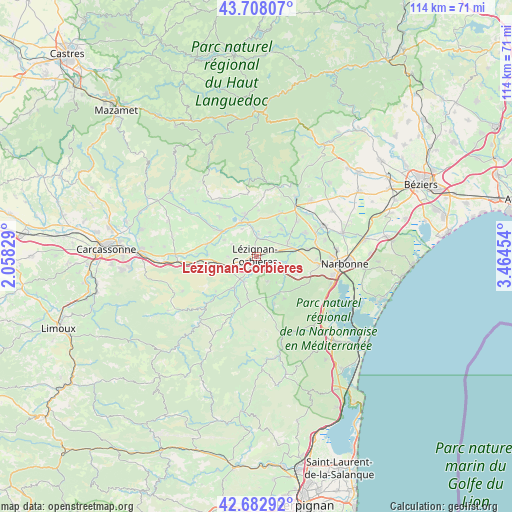
Lézignan-Corbières GPS coordinates[2]
43° 11' 51.54" North, 2° 45' 41.112" East
| Map corner | latitude | longitude |
|---|---|---|
| Upper-left | 43.70807°, | 2.05829° |
| Center: | 43.19765°, | 2.76142° |
| Lower-right: | 42.68292°, | 3.46454° |
| Map W x H: | 114×114 km | = 70.8×70.8mi |
| max Lat: | 51.07786° ⇑97.2% North |
| Lézignan-Corbières: | 43.19765° |
| min Lat: | ⇓2.8% South 41.3874° |
| min Long | Lézignan-Corbi | max Long |
| -5.08615° | 2.76142° | 9.52242° |
| W 54.4%⇐ | ⇒45.6% E |
Elevation
Elevation of Lézignan-Corbières is 49 m = 161 ft, and this is 144.7 m = 475 ft below average elevation for this country.
| Max E: |
2333 m = 7654 ft | 82.2% |
| Avg. | 193.7 m = 635 ft | |
| Lézignan-Corbières | 49 m = 161 ft | |
Min E: |
-1 m = -3 ft | 17.8% |
See also: France elevation on elevation.city.
Geographical zone
Lézignan-Corbières is located in North temperate zone (between Tropic of Cancer and the Arctic Circle). Distance of this Northern Tropic circle is 2197.2 km =1365.3 mi to South.| Distance of | km | miles | from Lézignan-Corbières |
|---|---|---|---|
| North Pole | 5203.9 | 3233.6 | to North |
| Arctic Circle | 2598 | 1614.3 | to North |
| Tropic Cancer | 2197.2 | 1365.3 | to South |
| Equator | 4803.1 | 2984.5 | to South |


Nearby cities:
15 places around Lézignan-Corbières: (largest is in red/bold)
• Bizanet
9.6 km =6 mi,  112°
112°
• Boutenac
6 km =3.7 mi,  156°
156°
• Canet
7.8 km =4.8 mi,  64°
64°
• Conilhac-Corbières
3.9 km =2.4 mi,  254°
254°
• Fabrezan
8.6 km =5.3 mi,  216°
216°
• Ferrals-les-Corbières
5.8 km =3.6 mi,  203°
203°
• Homps
8.4 km =5.2 mi,  336°
336°
• Luc-sur-Orbieu
3 km =1.9 mi,  140°
140°
• Moux
9 km =5.6 mi,  257°
257°
• Olonzac
9.8 km =6.1 mi,  345°
345°
• Ornaisons
6.4 km =4 mi, 107°
• Saint-André-de-Roquelongue
11 km =6.8 mi,  146°
146°
• Sainte-Valière
10.6 km =6.6 mi,  37°
37°
• Thézan-des-Corbières
10.9 km =6.8 mi,  177°
177°
• Ventenac-en-Minervois
10.3 km =6.4 mi, 55°
Sources, notices
• [Note1] Compared only with cities in France existing in our database
• [Src1] Map data: © OpenStreetMap contributors (CC-BY-SA)
• [Src2] Other city data from geonames.org with taken over terms of usage.
• [Src3] Geographical zone / Annual Mean Temperature by Robert A. Rohde @ Wikipedia
