Ormoy-la-Rivière geodata
Ormoy-la-Rivière (Île-de-France) is a populated place; located in France in Europe/Paris (GMT+2) time zone. With population of 942 people, there are 9275 cities with bigger population in this country. Compared to other cities in France, 66.4% of cities are located further ↓South; 55.1% of cities are located further →East and 66.6% of cities have higher elevation than Ormoy-la-Rivière. Note1
Administrative division(s):
- Level 1: Île-de-France
- Level 2: Département de l'Essonne
- Level 3: Arrondissement d'Étampes
- Level 4: Ormoy-la-Rivière


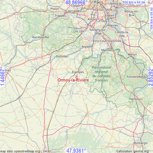
Ormoy-la-Rivière GPS coordinates[2]
48° 24' 18.072" North, 2° 8' 59.244" East
| Map corner | latitude | longitude |
|---|---|---|
| Upper-left | 48.86966°, | 1.44667° |
| Center: | 48.40502°, | 2.14979° |
| Lower-right: | 47.9361°, | 2.85292° |
| Map W x H: | 103.8×103.8 km | = 64.5×64.5mi |
| max Lat: | 51.07786° ⇑33.6% North |
| Ormoy-la-Rivière: | 48.40502° |
| min Lat: | ⇓66.4% South 41.3874° |
| min Long | Ormoy-la-Riviè | max Long |
| -5.08615° | 2.14979° | 9.52242° |
| W 44.9%⇐ | ⇒55.1% E |
Elevation
Elevation of Ormoy-la-Rivière is 86 m = 282 ft, and this is 107.7 m = 353 ft below average elevation for this country.
| Max E: |
2333 m = 7654 ft | 66.6% |
| Avg. | 193.7 m = 635 ft | |
| Ormoy-la-Rivière | 86 m = 282 ft | |
Min E: |
-1 m = -3 ft | 33.4% |
See also: France elevation on elevation.city.
Geographical zone
Ormoy-la-Rivière is located in North temperate zone (between Tropic of Cancer and the Arctic Circle). Distance of this North polar circle is 2019 km =1254.5 mi to North.| Distance of | km | miles | from Ormoy-la-Rivière |
|---|---|---|---|
| North Pole | 4624.9 | 2873.8 | to North |
| Arctic Circle | 2019 | 1254.5 | to North |
| Tropic Cancer | 2776.2 | 1725.1 | to South |
| Equator | 5382.1 | 3344.3 | to South |


Nearby cities:
15 places around Ormoy-la-Rivière: (largest is in red/bold)
• Auvers-Saint-Georges
11.1 km =6.9 mi,  28°
28°
• Boissy-le-Cutté
12.2 km =7.6 mi,  53°
53°
• Boissy-le-Sec
9.3 km =5.8 mi,  331°
331°
• Brières-les-Scellés
5.8 km =3.6 mi,  350°
350°
• Chalo-Saint-Mars
6.6 km =4.1 mi,  287°
287°
• Guillerval
5.8 km =3.6 mi,  218°
218°
• Morigny-Champigny
5.3 km =3.3 mi, 28°
• Méréville
11.1 km =6.9 mi,  205°
205°
• Saclas
5.5 km =3.4 mi,  200°
200°
• Sermaises
12.7 km =7.9 mi,  161°
161°
• Valpuiseaux
11.4 km =7.1 mi,  96°
96°
• Villeconin
12.3 km =7.6 mi, 351°
• Villeneuve-sur-Auvers
10.6 km =6.6 mi,  42°
42°
• Étampes
3.5 km =2.2 mi,  15°
15°
• Étréchy
10.5 km =6.5 mi, 18°
Sources, notices
• [Note1] Compared only with cities in France existing in our database
• [Src1] Map data: © OpenStreetMap contributors (CC-BY-SA)
• [Src2] Other city data from geonames.org with taken over terms of usage.
• [Src3] Geographical zone / Annual Mean Temperature by Robert A. Rohde @ Wikipedia
