Étampes geodata
Étampes (Île-de-France) is a seat of a third-order administrative division; located in France in Europe/Paris (GMT+2) time zone. With population of 23,012 people, there are 387 cities with bigger population in this country. Compared to other cities in France, 67% of cities are located further ↓South; 55% of cities are located further →East and 73.6% of cities have higher elevation than Étampes. Note1
Administrative division(s):
- Level 1: Île-de-France
- Level 2: Département de l'Essonne
- Level 3: Arrondissement d'Étampes
- Level 4: Étampes


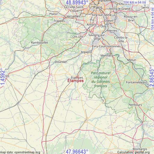
Étampes GPS coordinates[2]
48° 26' 6.252" North, 2° 9' 44.388" East
| Map corner | latitude | longitude |
|---|---|---|
| Upper-left | 48.89943°, | 1.4592° |
| Center: | 48.43507°, | 2.16233° |
| Lower-right: | 47.96643°, | 2.86545° |
| Map W x H: | 103.7×103.7 km | = 64.4×64.4mi |
| max Lat: | 51.07786° ⇑33% North |
| Étampes: | 48.43507° |
| min Lat: | ⇓67% South 41.3874° |
| min Long | Étampes | max Long |
| -5.08615° | 2.16233° | 9.52242° |
| W 45%⇐ | ⇒55% E |
Elevation
Elevation of Étampes is 70 m = 230 ft, and this is 123.7 m = 406 ft below average elevation for this country.
| Max E: |
2333 m = 7654 ft | 73.6% |
| Avg. | 193.7 m = 635 ft | |
| Étampes | 70 m = 230 ft | |
Min E: |
-1 m = -3 ft | 26.4% |
See also: France elevation on elevation.city.
Geographical zone
Étampes is located in North temperate zone (between Tropic of Cancer and the Arctic Circle). Distance of this North polar circle is 2015.7 km =1252.5 mi to North.| Distance of | km | miles | from Étampes |
|---|---|---|---|
| North Pole | 4621.6 | 2871.7 | to North |
| Arctic Circle | 2015.7 | 1252.5 | to North |
| Tropic Cancer | 2779.6 | 1727.2 | to South |
| Equator | 5385.5 | 3346.4 | to South |


Nearby cities:
15 places around Étampes: (largest is in red/bold)
• Auvers-Saint-Georges
7.7 km =4.8 mi,  33°
33°
• Boissy-le-Cutté
9.7 km =6 mi,  66°
66°
• Boissy-le-Sec
7.2 km =4.5 mi,  312°
312°
• Brières-les-Scellés
3 km =1.9 mi,  322°
322°
• Chalo-Saint-Mars
7.3 km =4.5 mi,  259°
259°
• Chamarande
10 km =6.2 mi,  23°
23°
• Guillerval
9.1 km =5.7 mi,  210°
210°
• Janville-sur-Juine
11.8 km =7.3 mi,  42°
42°
• Morigny-Champigny
2 km =1.2 mi,  50°
50°
• Ormoy-la-Rivière
3.5 km =2.2 mi,  195°
195°
• Saclas
9 km =5.6 mi, 198°
• Valpuiseaux
11.4 km =7.1 mi,  114°
114°
• Villeconin
9.2 km =5.7 mi,  342°
342°
• Villeneuve-sur-Auvers
7.7 km =4.8 mi, 54°
• Étréchy
7 km =4.3 mi, 19°
Sources, notices
• [Note1] Compared only with cities in France existing in our database
• [Src1] Map data: © OpenStreetMap contributors (CC-BY-SA)
• [Src2] Other city data from geonames.org with taken over terms of usage.
• [Src3] Geographical zone / Annual Mean Temperature by Robert A. Rohde @ Wikipedia
