Valpuiseaux geodata
Valpuiseaux (Île-de-France) is a populated place; located in France in Europe/Paris (GMT+2) time zone. With population of 541 people, there are 14367 cities with bigger population in this country. Compared to other cities in France, 66.2% of cities are located further ↓South; 52.6% of cities are located further →East and 69.2% of cities have higher elevation than Valpuiseaux. Note1
Administrative division(s):
- Level 1: Île-de-France
- Level 2: Département de l'Essonne
- Level 3: Arrondissement d'Étampes
- Level 4: Valpuiseaux


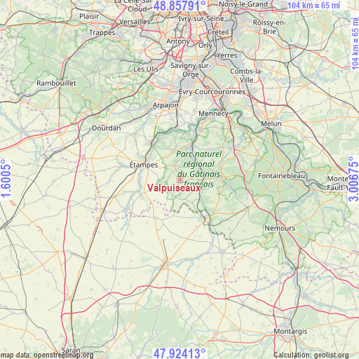
Valpuiseaux GPS coordinates[2]
48° 23' 35.376" North, 2° 18' 13.032" East
| Map corner | latitude | longitude |
|---|---|---|
| Upper-left | 48.85791°, | 1.6005° |
| Center: | 48.39316°, | 2.30362° |
| Lower-right: | 47.92413°, | 3.00675° |
| Map W x H: | 103.8×103.8 km | = 64.5×64.5mi |
| max Lat: | 51.07786° ⇑33.8% North |
| Valpuiseaux: | 48.39316° |
| min Lat: | ⇓66.2% South 41.3874° |
| min Long | Valpuiseaux | max Long |
| -5.08615° | 2.30362° | 9.52242° |
| W 47.4%⇐ | ⇒52.6% E |
Elevation
Elevation of Valpuiseaux is 80 m = 262 ft, and this is 113.7 m = 373 ft below average elevation for this country.
| Max E: |
2333 m = 7654 ft | 69.2% |
| Avg. | 193.7 m = 635 ft | |
| Valpuiseaux | 80 m = 262 ft | |
Min E: |
-1 m = -3 ft | 30.8% |
See also: France elevation on elevation.city.
Geographical zone
Valpuiseaux is located in North temperate zone (between Tropic of Cancer and the Arctic Circle). Distance of this North polar circle is 2020.4 km =1255.4 mi to North.| Distance of | km | miles | from Valpuiseaux |
|---|---|---|---|
| North Pole | 4626.2 | 2874.6 | to North |
| Arctic Circle | 2020.4 | 1255.4 | to North |
| Tropic Cancer | 2774.9 | 1724.2 | to South |
| Equator | 5380.8 | 3343.5 | to South |


Nearby cities:
15 places around Valpuiseaux: (largest is in red/bold)
• Baulne
11.9 km =7.4 mi,  21°
21°
• Boissy-le-Cutté
8.7 km =5.4 mi,  350°
350°
• Boutigny-sur-Essonne
7.4 km =4.6 mi,  52°
52°
• Buno-Bonnevaux
7.4 km =4.6 mi,  123°
123°
• Cerny
9.6 km =6 mi,  10°
10°
• Gironville-sur-Essonne
6.6 km =4.1 mi, 116°
• Guigneville-sur-Essonne
9.8 km =6.1 mi, 22°
• La Ferté-Alais
10.5 km =6.5 mi, 18°
• Maisse
5.6 km =3.5 mi,  87°
87°
• Morigny-Champigny
10.7 km =6.6 mi,  303°
303°
• Oncy-sur-École
12.1 km =7.5 mi,  95°
95°
• Ormoy-la-Rivière
11.4 km =7.1 mi,  276°
276°
• Vayres-sur-Essonne
5.6 km =3.5 mi,  37°
37°
• Villeneuve-sur-Auvers
10 km =6.2 mi,  335°
335°
• Étampes
11.4 km =7.1 mi,  294°
294°
Sources, notices
• [Note1] Compared only with cities in France existing in our database
• [Src1] Map data: © OpenStreetMap contributors (CC-BY-SA)
• [Src2] Other city data from geonames.org with taken over terms of usage.
• [Src3] Geographical zone / Annual Mean Temperature by Robert A. Rohde @ Wikipedia
