Orival geodata
Orival (Normandy) is a populated place; located in France in Europe/Paris (GMT+2) time zone. With population of 1,088 people, there are 8211 cities with bigger population in this country. Compared to other cities in France, 91.7% of cities are located further ↓South; 66.7% of cities are located further →East and 72.6% of cities have higher elevation than Orival. Note1
Administrative division(s):
- Level 1: Normandy
- Level 2: Seine-Maritime
- Level 3: Arrondissement de Dieppe
- Level 4: Saint-Hellier


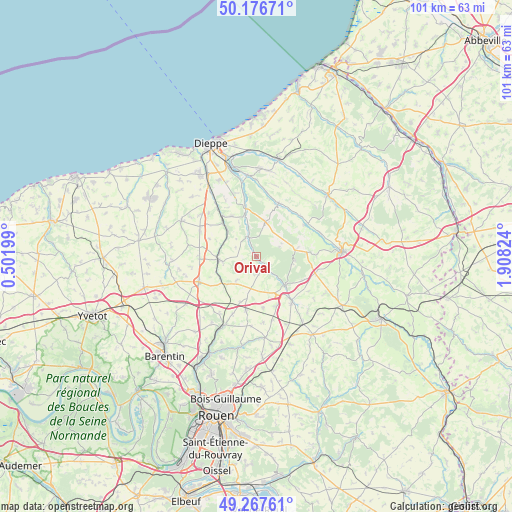
Orival GPS coordinates[2]
49° 43' 27.444" North, 1° 12' 18.432" East
| Map corner | latitude | longitude |
|---|---|---|
| Upper-left | 50.17671°, | 0.50199° |
| Center: | 49.72429°, | 1.20512° |
| Lower-right: | 49.26761°, | 1.90824° |
| Map W x H: | 101.1×101.1 km | = 62.8×62.8mi |
| max Lat: | 51.07786° ⇑8.3% North |
| Orival: | 49.72429° |
| min Lat: | ⇓91.7% South 41.3874° |
| min Long | Orival | max Long |
| -5.08615° | 1.20512° | 9.52242° |
| W 33.3%⇐ | ⇒66.7% E |
Elevation
Elevation of Orival is 72 m = 236 ft, and this is 121.7 m = 399 ft below average elevation for this country.
| Max E: |
2333 m = 7654 ft | 72.6% |
| Avg. | 193.7 m = 635 ft | |
| Orival | 72 m = 236 ft | |
Min E: |
-1 m = -3 ft | 27.4% |
See also: France elevation on elevation.city.
Geographical zone
Orival is located in North temperate zone (between Tropic of Cancer and the Arctic Circle). Distance of this North polar circle is 1872.4 km =1163.5 mi to North.| Distance of | km | miles | from Orival |
|---|---|---|---|
| North Pole | 4478.2 | 2782.6 | to North |
| Arctic Circle | 1872.4 | 1163.5 | to North |
| Tropic Cancer | 2922.9 | 1816.2 | to South |
| Equator | 5528.8 | 3435.4 | to South |


Nearby cities:
15 places around Orival: (largest is in red/bold)
• Auffay
7.6 km =4.7 mi,  265°
265°
• Bellencombre
2.4 km =1.5 mi,  141°
141°
• Biville-la-Baignarde
11.3 km =7 mi, 268°
• Bosc-le-Hard
11 km =6.8 mi,  191°
191°
• Bully
11.8 km =7.3 mi,  88°
88°
• Heugleville-sur-Scie
8.4 km =5.2 mi,  276°
276°
• Les Grandes-Ventes
7 km =4.3 mi,  14°
14°
• Longueville-sur-Scie
10.1 km =6.3 mi,  317°
317°
• Saint-Maclou-de-Folleville
8.5 km =5.3 mi,  236°
236°
• Saint-Martin-Osmonville
11.7 km =7.3 mi, 144°
• Saint-Saëns
8.1 km =5 mi,  134°
134°
• Saint-Vaast-d’Équiqueville
11.2 km =7 mi,  23°
23°
• Torcy-le-Grand
8.6 km =5.3 mi,  345°
345°
• Tôtes
12.4 km =7.7 mi,  247°
247°
• Étaimpuis
9.9 km =6.2 mi,  207°
207°
Sources, notices
• [Note1] Compared only with cities in France existing in our database
• [Src1] Map data: © OpenStreetMap contributors (CC-BY-SA)
• [Src2] Other city data from geonames.org with taken over terms of usage.
• [Src3] Geographical zone / Annual Mean Temperature by Robert A. Rohde @ Wikipedia
