Neufgrange geodata
Neufgrange (Grand Est) is a populated place; located in France in Europe/Paris (GMT+2) time zone. With population of 1,328 people, there are 6901 cities with bigger population in this country. Compared to other cities in France, 81.5% of cities are located further ↓South; 95.1% of cities are located further ←West and 72.2% of cities have lower elevation than Neufgrange. Note1
Administrative division(s):
- Level 1: Grand Est
- Level 2: Moselle
- Level 3: Arrondissement de Sarreguemines
- Level 4: Neufgrange


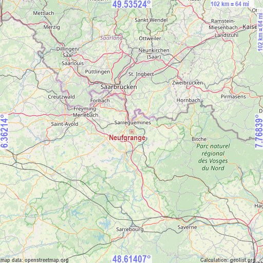
Neufgrange GPS coordinates[2]
49° 4' 36.444" North, 7° 3' 54.936" East
| Map corner | latitude | longitude |
|---|---|---|
| Upper-left | 49.53524°, | 6.36214° |
| Center: | 49.07679°, | 7.06526° |
| Lower-right: | 48.61407°, | 7.76839° |
| Map W x H: | 102.4×102.4 km | = 63.6×63.6mi |
| max Lat: | 51.07786° ⇑18.5% North |
| Neufgrange: | 49.07679° |
| min Lat: | ⇓81.5% South 41.3874° |
| min Long | Neufgrange | max Long |
| -5.08615° | 7.06526° | 9.52242° |
| W 95.1%⇐ | ⇒4.9% E |
Elevation
Elevation of Neufgrange is 231 m = 758 ft, and this is 37.3 m = 122 ft above average elevation for this country.
| Max E: |
2333 m = 7654 ft | 27.8% |
| Neufgrange | 231 m 758 ft | |
| Avg. | 193.7 m = 635 ft | |
Min E: |
-1 m = -3 ft | 72.2% |
See also: France elevation on elevation.city.
Geographical zone
Neufgrange is located in North temperate zone (between Tropic of Cancer and the Arctic Circle). Distance of this North polar circle is 1944.3 km =1208.1 mi to North.| Distance of | km | miles | from Neufgrange |
|---|---|---|---|
| North Pole | 4550.2 | 2827.4 | to North |
| Arctic Circle | 1944.3 | 1208.1 | to North |
| Tropic Cancer | 2850.9 | 1771.5 | to South |
| Equator | 5456.8 | 3390.7 | to South |


Nearby cities:
15 places around Neufgrange: (largest is in red/bold)
• Blies-Ébersing
7.8 km =4.8 mi,  48°
48°
• Ernestviller
7.3 km =4.5 mi,  262°
262°
• Grundviller
7.7 km =4.8 mi,  241°
241°
• Hambach
2.9 km =1.8 mi,  228°
228°
• Herbitzheim
6.9 km =4.3 mi,  169°
169°
• Hundling
7.2 km =4.5 mi,  299°
299°
• Ippling
5.5 km =3.4 mi,  306°
306°
• Rémelfing
2.2 km =1.4 mi, 49°
• Sarreguemines
3.7 km =2.3 mi,  2°
2°
• Sarreinsming
3.7 km =2.3 mi,  64°
64°
• Siltzheim
2.5 km =1.6 mi,  125°
125°
• Wiesviller
7.2 km =4.5 mi,  86°
86°
• Willerwald
6.1 km =3.8 mi,  199°
199°
• Wittring
6.2 km =3.9 mi,  114°
114°
• Woustviller
4.4 km =2.7 mi,  269°
269°
Sources, notices
• [Note1] Compared only with cities in France existing in our database
• [Src1] Map data: © OpenStreetMap contributors (CC-BY-SA)
• [Src2] Other city data from geonames.org with taken over terms of usage.
• [Src3] Geographical zone / Annual Mean Temperature by Robert A. Rohde @ Wikipedia
