Ippling geodata
Ippling (Grand Est) is a populated place; located in France in Europe/Paris (GMT+2) time zone. With population of 723 people, there are 11495 cities with bigger population in this country. Compared to other cities in France, 82.3% of cities are located further ↓South; 94.9% of cities are located further ←West and 70.1% of cities have lower elevation than Ippling. Note1
Administrative division(s):
- Level 1: Grand Est
- Level 2: Moselle
- Level 3: Arrondissement de Sarreguemines
- Level 4: Ippling


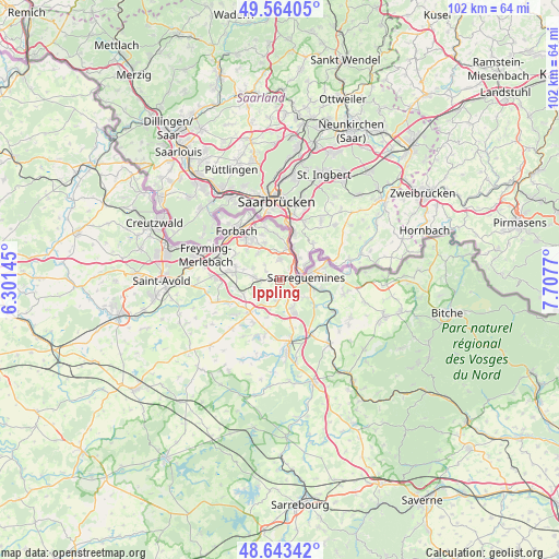
Ippling GPS coordinates[2]
49° 6' 21.132" North, 7° 0' 16.452" East
| Map corner | latitude | longitude |
|---|---|---|
| Upper-left | 49.56405°, | 6.30145° |
| Center: | 49.10587°, | 7.00457° |
| Lower-right: | 48.64342°, | 7.7077° |
| Map W x H: | 102.4×102.4 km | = 63.6×63.6mi |
| max Lat: | 51.07786° ⇑17.7% North |
| Ippling: | 49.10587° |
| min Lat: | ⇓82.3% South 41.3874° |
| min Long | Ippling | max Long |
| -5.08615° | 7.00457° | 9.52242° |
| W 94.9%⇐ | ⇒5.1% E |
Elevation
Elevation of Ippling is 220 m = 722 ft, and this is 26.3 m = 86 ft above average elevation for this country.
| Max E: |
2333 m = 7654 ft | 29.9% |
| Ippling | 220 m 722 ft | |
| Avg. | 193.7 m = 635 ft | |
Min E: |
-1 m = -3 ft | 70.1% |
See also: France elevation on elevation.city.
Geographical zone
Ippling is located in North temperate zone (between Tropic of Cancer and the Arctic Circle). Distance of this North polar circle is 1941.1 km =1206.1 mi to North.| Distance of | km | miles | from Ippling |
|---|---|---|---|
| North Pole | 4547 | 2825.4 | to North |
| Arctic Circle | 1941.1 | 1206.1 | to North |
| Tropic Cancer | 2854.1 | 1773.5 | to South |
| Equator | 5460.1 | 3392.7 | to South |


Nearby cities:
15 places around Ippling: (largest is in red/bold)
• Bousbach
6.2 km =3.9 mi,  320°
320°
• Diebling
4.7 km =2.9 mi,  275°
275°
• Ernestviller
5.1 km =3.2 mi,  214°
214°
• Grosbliederstroff
6 km =3.7 mi,  13°
13°
• Hambach
5.6 km =3.5 mi,  156°
156°
• Hundling
1.8 km =1.1 mi, 279°
• Lixing-lès-Rouhling
5.4 km =3.4 mi,  351°
351°
• Metzing
3.4 km =2.1 mi,  269°
269°
• Neufgrange
5.5 km =3.4 mi,  126°
126°
• Nousseviller-Saint-Nabor
3.1 km =1.9 mi,  303°
303°
• Rouhling
3.7 km =2.3 mi,  359°
359°
• Rémelfing
6.4 km =4 mi,  106°
106°
• Sarreguemines
4.6 km =2.9 mi,  84°
84°
• Tenteling
5.3 km =3.3 mi,  294°
294°
• Woustviller
3.3 km =2.1 mi,  179°
179°
Sources, notices
• [Note1] Compared only with cities in France existing in our database
• [Src1] Map data: © OpenStreetMap contributors (CC-BY-SA)
• [Src2] Other city data from geonames.org with taken over terms of usage.
• [Src3] Geographical zone / Annual Mean Temperature by Robert A. Rohde @ Wikipedia
