Neufchâtel-en-Bray geodata
Neufchâtel-en-Bray (Normandy) is a populated place; located in France in Europe/Paris (GMT+2) time zone. With population of 5,416 people, there are 1820 cities with bigger population in this country. Compared to other cities in France, 91.8% of cities are located further ↓South; 63.8% of cities are located further →East and 65.6% of cities have higher elevation than Neufchâtel-en-Bray. Note1
Administrative division(s):
- Level 1: Normandy
- Level 2: Seine-Maritime
- Level 3: Arrondissement de Dieppe
- Level 4: Neufchâtel-en-Bray


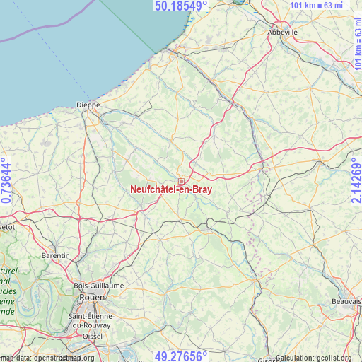
Neufchâtel-en-Bray GPS coordinates[2]
49° 43' 59.34" North, 1° 26' 22.416" East
| Map corner | latitude | longitude |
|---|---|---|
| Upper-left | 50.18549°, | 0.73644° |
| Center: | 49.73315°, | 1.43956° |
| Lower-right: | 49.27656°, | 2.14269° |
| Map W x H: | 101.1×101.1 km | = 62.8×62.8mi |
| max Lat: | 51.07786° ⇑8.2% North |
| Neufchâtel-en-Bray: | 49.73315° |
| min Lat: | ⇓91.8% South 41.3874° |
| min Long | Neufchâtel-en- | max Long |
| -5.08615° | 1.43956° | 9.52242° |
| W 36.2%⇐ | ⇒63.8% E |
Elevation
Elevation of Neufchâtel-en-Bray is 88 m = 289 ft, and this is 105.7 m = 347 ft below average elevation for this country.
| Max E: |
2333 m = 7654 ft | 65.6% |
| Avg. | 193.7 m = 635 ft | |
| Neufchâtel-en-Bray | 88 m = 289 ft | |
Min E: |
-1 m = -3 ft | 34.4% |
See also: France elevation on elevation.city.
Geographical zone
Neufchâtel-en-Bray is located in North temperate zone (between Tropic of Cancer and the Arctic Circle). Distance of this North polar circle is 1871.4 km =1162.8 mi to North.| Distance of | km | miles | from Neufchâtel-en-Bray |
|---|---|---|---|
| North Pole | 4477.3 | 2782.1 | to North |
| Arctic Circle | 1871.4 | 1162.8 | to North |
| Tropic Cancer | 2923.9 | 1816.8 | to South |
| Equator | 5529.8 | 3436.1 | to South |


Nearby cities:
15 places around Neufchâtel-en-Bray: (largest is in red/bold)
• Bellencombre
15.6 km =9.7 mi,  259°
259°
• Bully
5.1 km =3.2 mi, 262°
• Forges-les-Eaux
15.3 km =9.5 mi,  150°
150°
• Foucarmont
15.7 km =9.8 mi,  36°
36°
• Gaillefontaine
15.4 km =9.6 mi,  124°
124°
• Les Grandes-Ventes
16.2 km =10.1 mi,  291°
291°
• Londinières
11.3 km =7 mi,  346°
346°
• Mesnières-en-Bray
5.2 km =3.2 mi,  307°
307°
• Montérolier
13.2 km =8.2 mi,  210°
210°
• Neuville-Ferrières
2.7 km =1.7 mi, 151°
• Saint-Martin-Osmonville
14.6 km =9.1 mi,  223°
223°
• Saint-Saëns
13 km =8.1 mi,  238°
238°
• Saint-Vaast-d’Équiqueville
15.5 km =9.6 mi, 306°
• Serqueux
13.4 km =8.3 mi, 147°
• Sommery
11 km =6.8 mi,  179°
179°
Sources, notices
• [Note1] Compared only with cities in France existing in our database
• [Src1] Map data: © OpenStreetMap contributors (CC-BY-SA)
• [Src2] Other city data from geonames.org with taken over terms of usage.
• [Src3] Geographical zone / Annual Mean Temperature by Robert A. Rohde @ Wikipedia
