Montérolier geodata
Montérolier (Normandy) is a populated place; located in France in Europe/Paris (GMT+2) time zone. With population of 512 people, there are 14990 cities with bigger population in this country. Compared to other cities in France, 90.9% of cities are located further ↓South; 65.1% of cities are located further →East and 54.7% of cities have lower elevation than Montérolier. Note1
Administrative division(s):
- Level 1: Normandy
- Level 2: Seine-Maritime
- Level 3: Arrondissement de Dieppe
- Level 4: Montérolier


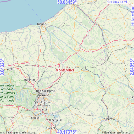
Montérolier GPS coordinates[2]
49° 37' 52.68" North, 1° 20' 47.076" East
| Map corner | latitude | longitude |
|---|---|---|
| Upper-left | 50.08459°, | 0.64328° |
| Center: | 49.6313°, | 1.34641° |
| Lower-right: | 49.17375°, | 2.04953° |
| Map W x H: | 101.3×101.3 km | = 62.9×62.9mi |
| max Lat: | 51.07786° ⇑9.1% North |
| Montérolier: | 49.6313° |
| min Lat: | ⇓90.9% South 41.3874° |
| min Long | Montérolier | max Long |
| -5.08615° | 1.34641° | 9.52242° |
| W 34.9%⇐ | ⇒65.1% E |
Elevation
Elevation of Montérolier is 149 m = 489 ft, and this is 44.7 m = 147 ft below average elevation for this country.
| Max E: |
2333 m = 7654 ft | 45.3% |
| Avg. | 193.7 m = 635 ft | |
| Montérolier | 149 m = 489 ft | |
Min E: |
-1 m = -3 ft | 54.7% |
See also: France elevation on elevation.city.
Geographical zone
Montérolier is located in North temperate zone (between Tropic of Cancer and the Arctic Circle). Distance of this North polar circle is 1882.7 km =1169.9 mi to North.| Distance of | km | miles | from Montérolier |
|---|---|---|---|
| North Pole | 4488.6 | 2789.1 | to North |
| Arctic Circle | 1882.7 | 1169.9 | to North |
| Tropic Cancer | 2912.6 | 1809.8 | to South |
| Equator | 5518.5 | 3429 | to South |


Nearby cities:
15 places around Montérolier: (largest is in red/bold)
• Bellencombre
12.1 km =7.5 mi,  314°
314°
• Bosc-le-Hard
12.4 km =7.7 mi,  267°
267°
• Buchy
5.2 km =3.2 mi,  170°
170°
• Bully
10.7 km =6.6 mi,  8°
8°
• Catenay
13.2 km =8.2 mi,  185°
185°
• Estouteville-Écalles
5.1 km =3.2 mi,  206°
206°
• Neufchâtel-en-Bray
13.2 km =8.2 mi,  30°
30°
• Neuville-Ferrières
12 km =7.5 mi,  41°
41°
• Rocquemont
5.5 km =3.4 mi,  236°
236°
• Saint-André-sur-Cailly
13.1 km =8.1 mi,  224°
224°
• Saint-Martin-Osmonville
3.5 km =2.2 mi,  283°
283°
• Saint-Saëns
6.4 km =4 mi,  316°
316°
• Sainte-Croix-sur-Buchy
7.4 km =4.6 mi,  177°
177°
• Sommery
6.8 km =4.2 mi,  87°
87°
• Vieux-Manoir
7.8 km =4.8 mi, 207°
Sources, notices
• [Note1] Compared only with cities in France existing in our database
• [Src1] Map data: © OpenStreetMap contributors (CC-BY-SA)
• [Src2] Other city data from geonames.org with taken over terms of usage.
• [Src3] Geographical zone / Annual Mean Temperature by Robert A. Rohde @ Wikipedia
