Logelheim geodata
Logelheim (Grand Est) is a populated place; located in France in Europe/Paris (GMT+2) time zone. With population of 613 people, there are 13109 cities with bigger population in this country. Compared to other cities in France, 59.6% of cities are located further ↓South; 97.3% of cities are located further ←West and 64.9% of cities have lower elevation than Logelheim. Note1
Administrative division(s):
- Level 1: Grand Est
- Level 2: Haut-Rhin
- Level 3: Arrondissement de Colmar-Ribeauvillé
- Level 4: Logelheim


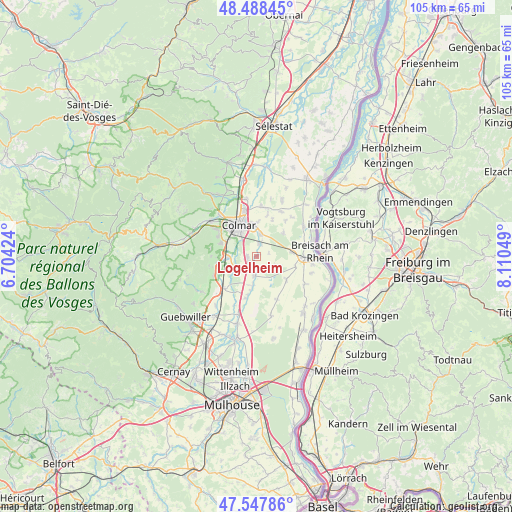
Logelheim GPS coordinates[2]
48° 1' 13.08" North, 7° 24' 26.496" East
| Map corner | latitude | longitude |
|---|---|---|
| Upper-left | 48.48845°, | 6.70424° |
| Center: | 48.0203°, | 7.40736° |
| Lower-right: | 47.54786°, | 8.11049° |
| Map W x H: | 104.6×104.6 km | = 65×65mi |
| max Lat: | 51.07786° ⇑40.4% North |
| Logelheim: | 48.0203° |
| min Lat: | ⇓59.6% South 41.3874° |
| min Long | Logelheim | max Long |
| -5.08615° | 7.40736° | 9.52242° |
| W 97.3%⇐ | ⇒2.7% E |
Elevation
Elevation of Logelheim is 193 m = 633 ft, and this is 0.69999999999999 m = 2 ft below average elevation for this country.
| Max E: |
2333 m = 7654 ft | 35.1% |
| Avg. | 193.7 m = 635 ft | |
| Logelheim | 193 m = 633 ft | |
Min E: |
-1 m = -3 ft | 64.9% |
See also: France elevation on elevation.city.
Geographical zone
Logelheim is located in North temperate zone (between Tropic of Cancer and the Arctic Circle). Distance of this North polar circle is 2061.8 km =1281.1 mi to North.| Distance of | km | miles | from Logelheim |
|---|---|---|---|
| North Pole | 4667.7 | 2900.4 | to North |
| Arctic Circle | 2061.8 | 1281.1 | to North |
| Tropic Cancer | 2733.4 | 1698.5 | to South |
| Equator | 5339.4 | 3317.7 | to South |


Nearby cities:
15 places around Logelheim: (largest is in red/bold)
• Andolsheim
4.7 km =2.9 mi,  8°
8°
• Bischwihr
8.8 km =5.5 mi, 14°
• Colmar
7.7 km =4.8 mi,  330°
330°
• Dessenheim
7.7 km =4.8 mi,  127°
127°
• Eguisheim
7.9 km =4.9 mi,  288°
288°
• Fortschwihr
8.2 km =5.1 mi,  22°
22°
• Hattstatt
8 km =5 mi,  262°
262°
• Herrlisheim-près-Colmar
6 km =3.7 mi,  267°
267°
• Horbourg-Wihr
6.8 km =4.2 mi,  351°
351°
• Niederhergheim
3.9 km =2.4 mi,  190°
190°
• Oberhergheim
6 km =3.7 mi, 188°
• Sainte-Croix-en-Plaine
2.1 km =1.3 mi,  231°
231°
• Sundhoffen
2.5 km =1.6 mi, 9°
• Widensolen
7.3 km =4.5 mi,  48°
48°
• Wolfgantzen
7 km =4.3 mi,  82°
82°
Sources, notices
• [Note1] Compared only with cities in France existing in our database
• [Src1] Map data: © OpenStreetMap contributors (CC-BY-SA)
• [Src2] Other city data from geonames.org with taken over terms of usage.
• [Src3] Geographical zone / Annual Mean Temperature by Robert A. Rohde @ Wikipedia
