Nantiat geodata
Nantiat (Nouvelle-Aquitaine) is a populated place; located in France in Europe/Paris (GMT+2) time zone. With population of 1,695 people, there are 5537 cities with bigger population in this country. Compared to other cities in France, 66.1% of cities are located further ↑North; 67.1% of cities are located further →East and 84.3% of cities have lower elevation than Nantiat. Note1
Administrative division(s):
- Level 1: Nouvelle-Aquitaine
- Level 2: Haute-Vienne
- Level 3: Arrondissement de Bellac
- Level 4: Nantiat


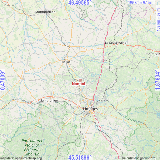
Nantiat GPS coordinates[2]
46° 0' 34.056" North, 1° 10' 23.592" East
| Map corner | latitude | longitude |
|---|---|---|
| Upper-left | 46.49565°, | 0.47009° |
| Center: | 46.00946°, | 1.17322° |
| Lower-right: | 45.51896°, | 1.87634° |
| Map W x H: | 108.6×108.6 km | = 67.5×67.5mi |
| max Lat: | 51.07786° ⇑66.1% North |
| Nantiat: | 46.00946° |
| min Lat: | ⇓33.9% South 41.3874° |
| min Long | Nantiat | max Long |
| -5.08615° | 1.17322° | 9.52242° |
| W 32.9%⇐ | ⇒67.1% E |
Elevation
Elevation of Nantiat is 339 m = 1112 ft, and this is 145.3 m = 477 ft above average elevation for this country.
| Max E: |
2333 m = 7654 ft | 15.7% |
| Nantiat | 339 m 1112 ft | |
| Avg. | 193.7 m = 635 ft | |
Min E: |
-1 m = -3 ft | 84.3% |
See also: France elevation on elevation.city.
Geographical zone
Nantiat is located in North temperate zone (between Tropic of Cancer and the Arctic Circle). Distance of this North polar circle is 2285.4 km =1420.1 mi to North.| Distance of | km | miles | from Nantiat |
|---|---|---|---|
| North Pole | 4891.3 | 3039.3 | to North |
| Arctic Circle | 2285.4 | 1420.1 | to North |
| Tropic Cancer | 2509.9 | 1559.6 | to South |
| Equator | 5115.8 | 3178.8 | to South |


Nearby cities:
15 places around Nantiat: (largest is in red/bold)
• Blond
12.6 km =7.8 mi,  288°
288°
• Bonnac-la-Côte
11.5 km =7.1 mi,  131°
131°
• Chamboret
2.8 km =1.7 mi,  260°
260°
• Chaptelat
12.9 km =8 mi,  149°
149°
• Cieux
10.1 km =6.3 mi, 258°
• Compreignac
8.1 km =5 mi,  103°
103°
• Couzeix
15.6 km =9.7 mi,  161°
161°
• Nieul
9.2 km =5.7 mi,  179°
179°
• Oradour-sur-Glane
13.9 km =8.6 mi,  232°
232°
• Peyrilhac
7.2 km =4.5 mi,  204°
204°
• Rancon
13.5 km =8.4 mi,  3°
3°
• Razès
13.5 km =8.4 mi,  78°
78°
• Saint-Gence
10.1 km =6.3 mi, 195°
• Saint-Jouvent
6.3 km =3.9 mi, 157°
• Veyrac
13.6 km =8.5 mi, 202°
Sources, notices
• [Note1] Compared only with cities in France existing in our database
• [Src1] Map data: © OpenStreetMap contributors (CC-BY-SA)
• [Src2] Other city data from geonames.org with taken over terms of usage.
• [Src3] Geographical zone / Annual Mean Temperature by Robert A. Rohde @ Wikipedia
