Chaptelat geodata
Chaptelat (Nouvelle-Aquitaine) is a populated place; located in France in Europe/Paris (GMT+2) time zone. With population of 1,506 people, there are 6171 cities with bigger population in this country. Compared to other cities in France, 67.5% of cities are located further ↑North; 66% of cities are located further →East and 85.1% of cities have lower elevation than Chaptelat. Note1
Administrative division(s):
- Level 1: Nouvelle-Aquitaine
- Level 2: Haute-Vienne
- Level 3: Arrondissement de Limoges
- Level 4: Chaptelat


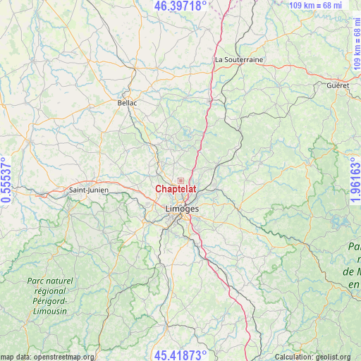
Chaptelat GPS coordinates[2]
45° 54' 36.396" North, 1° 15' 30.6" East
| Map corner | latitude | longitude |
|---|---|---|
| Upper-left | 46.39718°, | 0.55537° |
| Center: | 45.91011°, | 1.2585° |
| Lower-right: | 45.41873°, | 1.96163° |
| Map W x H: | 108.8×108.8 km | = 67.6×67.6mi |
| max Lat: | 51.07786° ⇑67.5% North |
| Chaptelat: | 45.91011° |
| min Lat: | ⇓32.5% South 41.3874° |
| min Long | Chaptelat | max Long |
| -5.08615° | 1.2585° | 9.52242° |
| W 34%⇐ | ⇒66% E |
Elevation
Elevation of Chaptelat is 348 m = 1142 ft, and this is 154.3 m = 506 ft above average elevation for this country.
| Max E: |
2333 m = 7654 ft | 14.9% |
| Chaptelat | 348 m 1142 ft | |
| Avg. | 193.7 m = 635 ft | |
Min E: |
-1 m = -3 ft | 85.1% |
See also: France elevation on elevation.city.
Geographical zone
Chaptelat is located in North temperate zone (between Tropic of Cancer and the Arctic Circle). Distance of this North polar circle is 2296.4 km =1426.9 mi to North.| Distance of | km | miles | from Chaptelat |
|---|---|---|---|
| North Pole | 4902.3 | 3046.1 | to North |
| Arctic Circle | 2296.4 | 1426.9 | to North |
| Tropic Cancer | 2498.8 | 1552.7 | to South |
| Equator | 5104.7 | 3171.9 | to South |


Nearby cities:
15 places around Chaptelat: (largest is in red/bold)
• Bonnac-la-Côte
4 km =2.5 mi,  30°
30°
• Compreignac
9.2 km =5.7 mi,  7°
7°
• Couzeix
4.1 km =2.5 mi,  202°
202°
• Isle
12 km =7.5 mi,  192°
192°
• Le Palais-sur-Vienne
7.2 km =4.5 mi,  135°
135°
• Limoges
8.5 km =5.3 mi, 185°
• Nieul
6.7 km =4.2 mi,  285°
285°
• Panazol
8.9 km =5.5 mi,  153°
153°
• Peyrilhac
10.6 km =6.6 mi,  295°
295°
• Rilhac-Rancon
4.8 km =3 mi,  106°
106°
• Saint-Gence
9.4 km =5.8 mi,  277°
277°
• Saint-Jouvent
6.7 km =4.2 mi,  321°
321°
• Saint-Just-le-Martel
11.2 km =7 mi,  118°
118°
• Saint-Priest-Taurion
11.2 km =7 mi,  103°
103°
• Veyrac
11.9 km =7.4 mi,  262°
262°
Sources, notices
• [Note1] Compared only with cities in France existing in our database
• [Src1] Map data: © OpenStreetMap contributors (CC-BY-SA)
• [Src2] Other city data from geonames.org with taken over terms of usage.
• [Src3] Geographical zone / Annual Mean Temperature by Robert A. Rohde @ Wikipedia
