Rothau geodata
Rothau (Grand Est) is a populated place; located in France in Europe/Paris (GMT+2) time zone. With population of 1,653 people, there are 5654 cities with bigger population in this country. Compared to other cities in France, 67.4% of cities are located further ↓South; 95.8% of cities are located further ←West and 84.9% of cities have lower elevation than Rothau. Note1
Administrative division(s):
- Level 1: Grand Est
- Level 2: Bas-Rhin
- Level 3: Arrondissement de Molsheim
- Level 4: Rothau


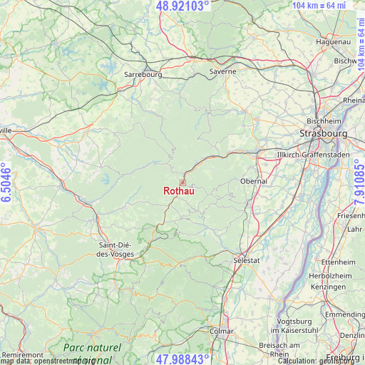
Rothau GPS coordinates[2]
48° 27' 24.732" North, 7° 12' 27.792" East
| Map corner | latitude | longitude |
|---|---|---|
| Upper-left | 48.92103°, | 6.5046° |
| Center: | 48.45687°, | 7.20772° |
| Lower-right: | 47.98843°, | 7.91085° |
| Map W x H: | 103.7×103.7 km | = 64.4×64.4mi |
| max Lat: | 51.07786° ⇑32.6% North |
| Rothau: | 48.45687° |
| min Lat: | ⇓67.4% South 41.3874° |
| min Long | Rothau | max Long |
| -5.08615° | 7.20772° | 9.52242° |
| W 95.8%⇐ | ⇒4.2% E |
Elevation
Elevation of Rothau is 345 m = 1132 ft, and this is 151.3 m = 496 ft above average elevation for this country.
| Max E: |
2333 m = 7654 ft | 15.1% |
| Rothau | 345 m 1132 ft | |
| Avg. | 193.7 m = 635 ft | |
Min E: |
-1 m = -3 ft | 84.9% |
See also: France elevation on elevation.city.
Geographical zone
Rothau is located in North temperate zone (between Tropic of Cancer and the Arctic Circle). Distance of this North polar circle is 2013.3 km =1251 mi to North.| Distance of | km | miles | from Rothau |
|---|---|---|---|
| North Pole | 4619.2 | 2870.2 | to North |
| Arctic Circle | 2013.3 | 1251 | to North |
| Tropic Cancer | 2782 | 1728.7 | to South |
| Equator | 5387.9 | 3347.9 | to South |


Nearby cities:
15 places around Rothau: (largest is in red/bold)
• Barembach
2.9 km =1.8 mi,  33°
33°
• Breitenbach
11.9 km =7.4 mi,  149°
149°
• Grendelbruch
9.3 km =5.8 mi,  64°
64°
• La Broque
1.9 km =1.2 mi,  19°
19°
• Lutzelhouse
9.2 km =5.7 mi,  39°
39°
• Maisonsgoutte
12.3 km =7.6 mi,  160°
160°
• Muhlbach-sur-Bruche
9.3 km =5.8 mi,  45°
45°
• Natzwiller
4.2 km =2.6 mi,  120°
120°
• Niederhaslach
13.8 km =8.6 mi, 46°
• Plaine
6.3 km =3.9 mi,  226°
226°
• Russ
5.8 km =3.6 mi, 41°
• Schirmeck
3.1 km =1.9 mi, 17°
• Steige
10.7 km =6.6 mi,  169°
169°
• Urmatt
11.7 km =7.3 mi, 47°
• Wisches
7.3 km =4.5 mi, 37°
Sources, notices
• [Note1] Compared only with cities in France existing in our database
• [Src1] Map data: © OpenStreetMap contributors (CC-BY-SA)
• [Src2] Other city data from geonames.org with taken over terms of usage.
• [Src3] Geographical zone / Annual Mean Temperature by Robert A. Rohde @ Wikipedia
