Templeuve-en-Pévèle geodata
Templeuve-en-Pévèle (Hauts-de-France) is a populated place; located in France in Europe/Paris (GMT+2) time zone. With population of 5,901 people, there are 1674 cities with bigger population in this country. Compared to other cities in France, 97.6% of cities are located further ↓South; 60.3% of cities are located further ←West and 84.5% of cities have higher elevation than Templeuve-en-Pévèle. Note1
Administrative division(s):
- Level 1: Hauts-de-France
- Level 2: Nord
- Level 3: Arrondissement de Lille
- Level 4: Templeuve-en-Pévèle


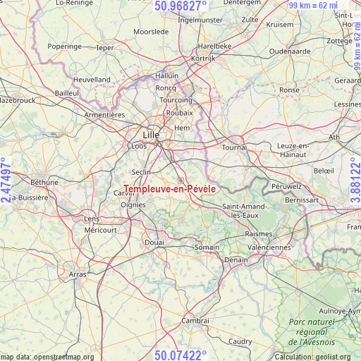
Templeuve-en-Pévèle GPS coordinates[2]
50° 31' 24.096" North, 3° 10' 41.124" East
| Map corner | latitude | longitude |
|---|---|---|
| Upper-left | 50.96827°, | 2.47497° |
| Center: | 50.52336°, | 3.17809° |
| Lower-right: | 50.07422°, | 3.88122° |
| Map W x H: | 99.4×99.4 km | = 61.8×61.8mi |
| max Lat: | 51.07786° ⇑2.4% North |
| Templeuve-en-Pévèle: | 50.52336° |
| min Lat: | ⇓97.6% South 41.3874° |
| min Long | Templeuve-en-P� | max Long |
| -5.08615° | 3.17809° | 9.52242° |
| W 60.3%⇐ | ⇒39.7% E |
Elevation
Elevation of Templeuve-en-Pévèle is 43 m = 141 ft, and this is 150.7 m = 494 ft below average elevation for this country.
| Max E: |
2333 m = 7654 ft | 84.5% |
| Avg. | 193.7 m = 635 ft | |
| Templeuve-en-Pévèle | 43 m = 141 ft | |
Min E: |
-1 m = -3 ft | 15.5% |
See also: France elevation on elevation.city.
Geographical zone
Templeuve-en-Pévèle is located in North temperate zone (between Tropic of Cancer and the Arctic Circle). Distance of this North polar circle is 1783.5 km =1108.2 mi to North.| Distance of | km | miles | from Templeuve-en-Pévèle |
|---|---|---|---|
| North Pole | 4389.4 | 2727.4 | to North |
| Arctic Circle | 1783.5 | 1108.2 | to North |
| Tropic Cancer | 3011.8 | 1871.4 | to South |
| Equator | 5617.7 | 3490.7 | to South |


Nearby cities:
15 places around Templeuve-en-Pévèle: (largest is in red/bold)
• Bachy
6.5 km =4 mi,  62°
62°
• Bersée
5.3 km =3.3 mi,  203°
203°
• Bourghelles
6.6 km =4.1 mi,  45°
45°
• Bouvines
6.2 km =3.9 mi,  7°
7°
• Cappelle-en-Pévèle
1.5 km =0.9 mi, 197°
• Cobrieux
4.1 km =2.5 mi, 59°
• Cysoing
5.8 km =3.6 mi,  27°
27°
• Ennevelin
4 km =2.5 mi,  300°
300°
• Fretin
4.8 km =3 mi,  322°
322°
• Genech
2.9 km =1.8 mi,  72°
72°
• Louvil
4 km =2.5 mi,  15°
15°
• Mérignies
5.2 km =3.2 mi,  248°
248°
• Nomain
5.8 km =3.6 mi,  118°
118°
• Pont-à-Marcq
4.5 km =2.8 mi,  268°
268°
• Péronne-en-Mélantois
5 km =3.1 mi,  352°
352°
Sources, notices
• [Note1] Compared only with cities in France existing in our database
• [Src1] Map data: © OpenStreetMap contributors (CC-BY-SA)
• [Src2] Other city data from geonames.org with taken over terms of usage.
• [Src3] Geographical zone / Annual Mean Temperature by Robert A. Rohde @ Wikipedia
