Morgny-la-Pommeraye geodata
Morgny-la-Pommeraye (Normandy) is a populated place; located in France in Europe/Paris (GMT+2) time zone. With population of 909 people, there are 9582 cities with bigger population in this country. Compared to other cities in France, 89.4% of cities are located further ↓South; 66.1% of cities are located further →East and 57.6% of cities have lower elevation than Morgny-la-Pommeraye. Note1
Administrative division(s):
- Level 1: Normandy
- Level 2: Seine-Maritime
- Level 3: Arrondissement de Rouen
- Level 4: Morgny-la-Pommeraye


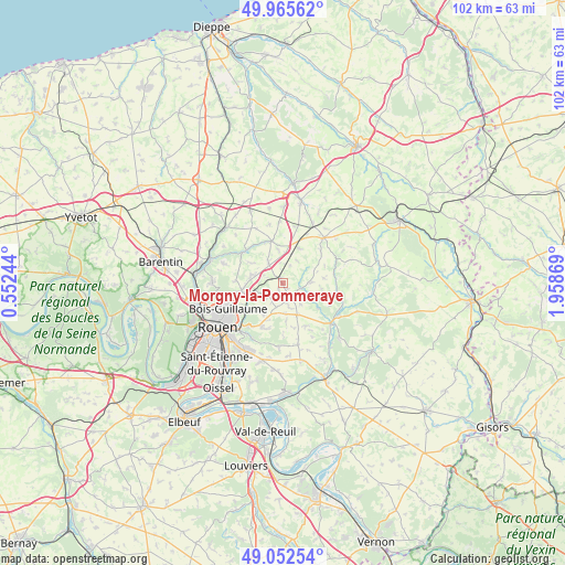
Morgny-la-Pommeraye GPS coordinates[2]
49° 30' 40.356" North, 1° 15' 20.052" East
| Map corner | latitude | longitude |
|---|---|---|
| Upper-left | 49.96562°, | 0.55244° |
| Center: | 49.51121°, | 1.25557° |
| Lower-right: | 49.05254°, | 1.95869° |
| Map W x H: | 101.5×101.5 km | = 63.1×63.1mi |
| max Lat: | 51.07786° ⇑10.6% North |
| Morgny-la-Pommeraye: | 49.51121° |
| min Lat: | ⇓89.4% South 41.3874° |
| min Long | Morgny-la-Pomme | max Long |
| -5.08615° | 1.25557° | 9.52242° |
| W 33.9%⇐ | ⇒66.1% E |
Elevation
Elevation of Morgny-la-Pommeraye is 160 m = 525 ft, and this is 33.7 m = 111 ft below average elevation for this country.
| Max E: |
2333 m = 7654 ft | 42.4% |
| Avg. | 193.7 m = 635 ft | |
| Morgny-la-Pommeraye | 160 m = 525 ft | |
Min E: |
-1 m = -3 ft | 57.6% |
See also: France elevation on elevation.city.
Geographical zone
Morgny-la-Pommeraye is located in North temperate zone (between Tropic of Cancer and the Arctic Circle). Distance of this North polar circle is 1896 km =1178.1 mi to North.| Distance of | km | miles | from Morgny-la-Pommeraye |
|---|---|---|---|
| North Pole | 4501.9 | 2797.4 | to North |
| Arctic Circle | 1896 | 1178.1 | to North |
| Tropic Cancer | 2899.2 | 1801.5 | to South |
| Equator | 5505.1 | 3420.7 | to South |


Nearby cities:
15 places around Morgny-la-Pommeraye: (largest is in red/bold)
• Auzouville-sur-Ry
8.7 km =5.4 mi,  152°
152°
• Blainville-Crevon
3.3 km =2.1 mi,  104°
104°
• Catenay
5.2 km =3.2 mi,  87°
87°
• Isneauville
7.5 km =4.7 mi,  258°
258°
• Martainville-Épreville
6.3 km =3.9 mi, 154°
• Préaux
3.6 km =2.2 mi,  232°
232°
• Quincampoix
5.2 km =3.2 mi,  290°
290°
• Roncherolles-sur-le-Vivier
7.2 km =4.5 mi, 226°
• Ry
7.7 km =4.8 mi,  125°
125°
• Saint-André-sur-Cailly
4.7 km =2.9 mi,  326°
326°
• Saint-Georges-sur-Fontaine
6.5 km =4 mi,  303°
303°
• Saint-Jacques-sur-Darnétal
8.8 km =5.5 mi,  205°
205°
• Saint-Martin-du-Vivier
8.1 km =5 mi, 232°
• Servaville-Salmonville
4.1 km =2.5 mi,  164°
164°
• Vieux-Manoir
7 km =4.3 mi,  24°
24°
Sources, notices
• [Note1] Compared only with cities in France existing in our database
• [Src1] Map data: © OpenStreetMap contributors (CC-BY-SA)
• [Src2] Other city data from geonames.org with taken over terms of usage.
• [Src3] Geographical zone / Annual Mean Temperature by Robert A. Rohde @ Wikipedia
