Saint-Georges-sur-Fontaine geodata
Saint-Georges-sur-Fontaine (Normandy) is a populated place; located in France in Europe/Paris (GMT+2) time zone. With population of 835 people, there are 10242 cities with bigger population in this country. Compared to other cities in France, 89.9% of cities are located further ↓South; 67% of cities are located further →East and 59.1% of cities have lower elevation than Saint-Georges-sur-Fontaine. Note1
Administrative division(s):
- Level 1: Normandy
- Level 2: Seine-Maritime
- Level 3: Arrondissement de Rouen
- Level 4: Saint-Georges-sur-Fontaine
Current local time in Saint-Georges-sur-Fontaine:
09:59 AM, SaturdayDifference from your time zone: hours


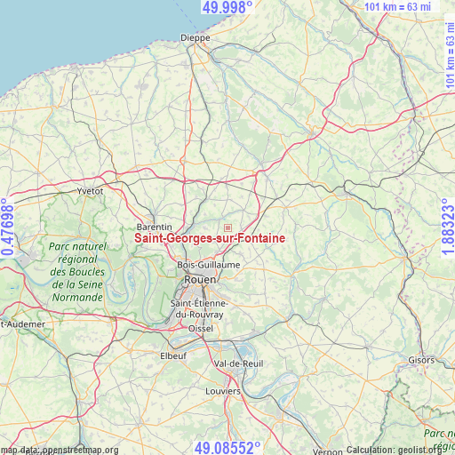
Saint-Georges-sur-Fontaine GPS coordinates[2]
49° 32' 38.004" North, 1° 10' 48.36" East
| Map corner | latitude | longitude |
|---|---|---|
| Upper-left | 49.998°, | 0.47698° |
| Center: | 49.54389°, | 1.1801° |
| Lower-right: | 49.08552°, | 1.88323° |
| Map W x H: | 101.5×101.5 km | = 63.1×63.1mi |
| max Lat: | 51.07786° ⇑10.1% North |
| Saint-Georges-sur-Fontaine: | 49.54389° |
| min Lat: | ⇓89.9% South 41.3874° |
| min Long | Saint-Georges-s | max Long |
| -5.08615° | 1.1801° | 9.52242° |
| W 33%⇐ | ⇒67% E |
Elevation
Elevation of Saint-Georges-sur-Fontaine is 166 m = 545 ft, and this is 27.7 m = 91 ft below average elevation for this country.
| Max E: |
2333 m = 7654 ft | 40.9% |
| Avg. | 193.7 m = 635 ft | |
| Saint-Georges-sur-Fontaine | 166 m = 545 ft | |
Min E: |
-1 m = -3 ft | 59.1% |
See also: France elevation on elevation.city.
Geographical zone
Saint-Georges-sur-Fontaine is located in North temperate zone (between Tropic of Cancer and the Arctic Circle). Distance of this North polar circle is 1892.4 km =1175.9 mi to North.| Distance of | km | miles | from Saint-Georges-sur-Fontaine |
|---|---|---|---|
| North Pole | 4498.3 | 2795.1 | to North |
| Arctic Circle | 1892.4 | 1175.9 | to North |
| Tropic Cancer | 2902.8 | 1803.7 | to South |
| Equator | 5508.8 | 3423 | to South |


Nearby cities:
15 places around Saint-Georges-sur-Fontaine: (largest is in red/bold)
• Bosc-Guérard-Saint-Adrien
4.6 km =2.9 mi,  266°
266°
• Bosc-le-Hard
9.3 km =5.8 mi,  357°
357°
• Clères
7.7 km =4.8 mi,  323°
323°
• Eslettes
9 km =5.6 mi, 273°
• Fontaine-le-Bourg
2.6 km =1.6 mi,  333°
333°
• Houppeville
8 km =5 mi,  244°
244°
• Isneauville
5.4 km =3.4 mi,  200°
200°
• Mont-Cauvaire
5.9 km =3.7 mi,  300°
300°
• Morgny-la-Pommeraye
6.5 km =4 mi,  123°
123°
• Préaux
6.4 km =4 mi,  156°
156°
• Quincampoix
2 km =1.2 mi, 162°
• Roncherolles-sur-le-Vivier
8.6 km =5.3 mi,  178°
178°
• Saint-André-sur-Cailly
2.9 km =1.8 mi,  83°
83°
• Saint-Martin-du-Vivier
8.6 km =5.3 mi,  186°
186°
• Vieux-Manoir
8.9 km =5.5 mi,  71°
71°
Sources, notices
• [Note1] Compared only with cities in France existing in our database
• [Src1] Map data: © OpenStreetMap contributors (CC-BY-SA)
• [Src2] Other city data from geonames.org with taken over terms of usage.
• [Src3] Geographical zone / Annual Mean Temperature by Robert A. Rohde @ Wikipedia
