Mont-Saint-Sulpice geodata
Mont-Saint-Sulpice (Bourgogne-Franche-Comté) is a populated place; located in France in Europe/Paris (GMT+2) time zone. With population of 840 people, there are 10186 cities with bigger population in this country. Compared to other cities in France, 58.5% of cities are located further ↓South; 65.2% of cities are located further ←West and 62.4% of cities have lower elevation than Mont-Saint-Sulpice. Note1
Administrative division(s):
- Level 1: Bourgogne-Franche-Comté
- Level 2: Département de l'Yonne
- Level 3: Auxerre
- Level 4: Mont-Saint-Sulpice


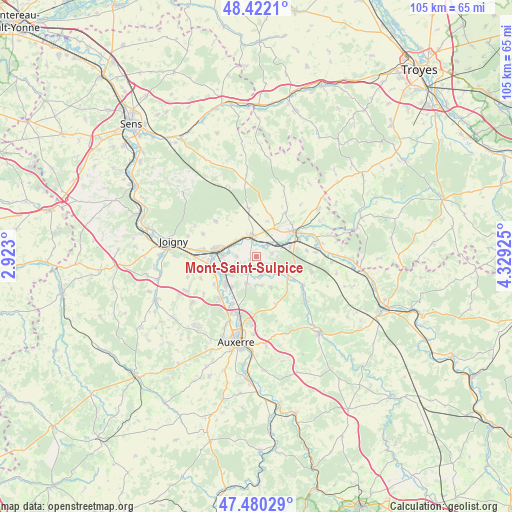
Mont-Saint-Sulpice GPS coordinates[2]
47° 57' 12.024" North, 3° 37' 34.068" East
| Map corner | latitude | longitude |
|---|---|---|
| Upper-left | 48.4221°, | 2.923° |
| Center: | 47.95334°, | 3.62613° |
| Lower-right: | 47.48029°, | 4.32925° |
| Map W x H: | 104.7×104.7 km | = 65.1×65.1mi |
| max Lat: | 51.07786° ⇑41.5% North |
| Mont-Saint-Sulpice: | 47.95334° |
| min Lat: | ⇓58.5% South 41.3874° |
| min Long | Mont-Saint-Sulp | max Long |
| -5.08615° | 3.62613° | 9.52242° |
| W 65.2%⇐ | ⇒34.8% E |
Elevation
Elevation of Mont-Saint-Sulpice is 181 m = 594 ft, and this is 12.7 m = 42 ft below average elevation for this country.
| Max E: |
2333 m = 7654 ft | 37.6% |
| Avg. | 193.7 m = 635 ft | |
| Mont-Saint-Sulpice | 181 m = 594 ft | |
Min E: |
-1 m = -3 ft | 62.4% |
See also: France elevation on elevation.city.
Geographical zone
Mont-Saint-Sulpice is located in North temperate zone (between Tropic of Cancer and the Arctic Circle). Distance of this North polar circle is 2069.3 km =1285.8 mi to North.| Distance of | km | miles | from Mont-Saint-Sulpice |
|---|---|---|---|
| North Pole | 4675.2 | 2905 | to North |
| Arctic Circle | 2069.3 | 1285.8 | to North |
| Tropic Cancer | 2726 | 1693.9 | to South |
| Equator | 5331.9 | 3313.1 | to South |


Nearby cities:
15 places around Mont-Saint-Sulpice: (largest is in red/bold)
• Bassou
9 km =5.6 mi,  248°
248°
• Bonnard
8.1 km =5 mi, 246°
• Brienon-sur-Armançon
4.2 km =2.6 mi,  349°
349°
• Champlost
8.6 km =5.3 mi,  22°
22°
• Chemilly-sur-Yonne
7.8 km =4.8 mi,  218°
218°
• Cheny
6.9 km =4.3 mi,  268°
268°
• Gurgy
10.7 km =6.6 mi,  205°
205°
• Héry
5.8 km =3.6 mi,  178°
178°
• Migennes
8.2 km =5.1 mi,  279°
279°
• Montigny-la-Resle
10.5 km =6.5 mi,  157°
157°
• Ormoy
3.9 km =2.4 mi, 269°
• Pontigny
8.3 km =5.2 mi,  129°
129°
• Saint-Florentin
9 km =5.6 mi,  54°
54°
• Seignelay
5.6 km =3.5 mi,  199°
199°
• Vergigny
7.1 km =4.4 mi,  74°
74°
Sources, notices
• [Note1] Compared only with cities in France existing in our database
• [Src1] Map data: © OpenStreetMap contributors (CC-BY-SA)
• [Src2] Other city data from geonames.org with taken over terms of usage.
• [Src3] Geographical zone / Annual Mean Temperature by Robert A. Rohde @ Wikipedia
