Migennes geodata
Migennes (Bourgogne-Franche-Comté) is a populated place; located in France in Europe/Paris (GMT+2) time zone. With population of 8,637 people, there are 1114 cities with bigger population in this country. Compared to other cities in France, 58.7% of cities are located further ↓South; 64.4% of cities are located further ←West and 66.6% of cities have higher elevation than Migennes. Note1
Administrative division(s):
- Level 1: Bourgogne-Franche-Comté
- Level 2: Département de l'Yonne
- Level 3: Auxerre
- Level 4: Migennes


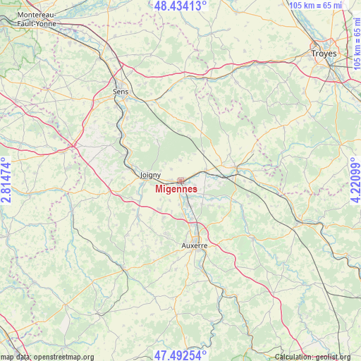
Migennes GPS coordinates[2]
47° 57' 55.728" North, 3° 31' 4.332" East
| Map corner | latitude | longitude |
|---|---|---|
| Upper-left | 48.43413°, | 2.81474° |
| Center: | 47.96548°, | 3.51787° |
| Lower-right: | 47.49254°, | 4.22099° |
| Map W x H: | 104.7×104.7 km | = 65.1×65.1mi |
| max Lat: | 51.07786° ⇑41.3% North |
| Migennes: | 47.96548° |
| min Lat: | ⇓58.7% South 41.3874° |
| min Long | Migennes | max Long |
| -5.08615° | 3.51787° | 9.52242° |
| W 64.4%⇐ | ⇒35.6% E |
Elevation
Elevation of Migennes is 86 m = 282 ft, and this is 107.7 m = 353 ft below average elevation for this country.
| Max E: |
2333 m = 7654 ft | 66.6% |
| Avg. | 193.7 m = 635 ft | |
| Migennes | 86 m = 282 ft | |
Min E: |
-1 m = -3 ft | 33.4% |
See also: France elevation on elevation.city.
Geographical zone
Migennes is located in North temperate zone (between Tropic of Cancer and the Arctic Circle). Distance of this North polar circle is 2067.9 km =1284.9 mi to North.| Distance of | km | miles | from Migennes |
|---|---|---|---|
| North Pole | 4673.8 | 2904.2 | to North |
| Arctic Circle | 2067.9 | 1284.9 | to North |
| Tropic Cancer | 2727.3 | 1694.7 | to South |
| Equator | 5333.3 | 3314 | to South |


Nearby cities:
15 places around Migennes: (largest is in red/bold)
• Appoigny
10.1 km =6.3 mi,  176°
176°
• Bassou
4.6 km =2.9 mi, 183°
• Bonnard
4.6 km =2.9 mi,  171°
171°
• Brienon-sur-Armançon
7.8 km =4.8 mi,  69°
69°
• Brion
4.4 km =2.7 mi,  320°
320°
• Bussy-en-Othe
6 km =3.7 mi,  357°
357°
• Champlay
6.1 km =3.8 mi,  255°
255°
• Chemilly-sur-Yonne
8.2 km =5.1 mi,  156°
156°
• Cheny
1.9 km =1.2 mi,  143°
143°
• Joigny
8.9 km =5.5 mi,  282°
282°
• Laroche-Saint-Cydroine
2.5 km =1.6 mi, 276°
• Mont-Saint-Sulpice
8.2 km =5.1 mi,  99°
99°
• Ormoy
4.4 km =2.7 mi,  108°
108°
• Seignelay
9.1 km =5.7 mi, 137°
• Épineau-les-Voves
3.2 km =2 mi,  238°
238°
Sources, notices
• [Note1] Compared only with cities in France existing in our database
• [Src1] Map data: © OpenStreetMap contributors (CC-BY-SA)
• [Src2] Other city data from geonames.org with taken over terms of usage.
• [Src3] Geographical zone / Annual Mean Temperature by Robert A. Rohde @ Wikipedia
