Chemilly-sur-Yonne geodata
Chemilly-sur-Yonne (Bourgogne-Franche-Comté) is a populated place; located in France in Europe/Paris (GMT+2) time zone. With population of 948 people, there are 9217 cities with bigger population in this country. Compared to other cities in France, 57.5% of cities are located further ↓South; 64.8% of cities are located further ←West and 60% of cities have higher elevation than Chemilly-sur-Yonne. Note1
Administrative division(s):
- Level 1: Bourgogne-Franche-Comté
- Level 2: Département de l'Yonne
- Level 3: Auxerre
- Level 4: Chemilly-sur-Yonne


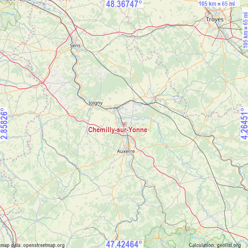
Chemilly-sur-Yonne GPS coordinates[2]
47° 53' 53.52" North, 3° 33' 41.004" East
| Map corner | latitude | longitude |
|---|---|---|
| Upper-left | 48.36747°, | 2.85826° |
| Center: | 47.8982°, | 3.56139° |
| Lower-right: | 47.42464°, | 4.26451° |
| Map W x H: | 104.8×104.8 km | = 65.1×65.1mi |
| max Lat: | 51.07786° ⇑42.5% North |
| Chemilly-sur-Yonne: | 47.8982° |
| min Lat: | ⇓57.5% South 41.3874° |
| min Long | Chemilly-sur-Yo | max Long |
| -5.08615° | 3.56139° | 9.52242° |
| W 64.8%⇐ | ⇒35.2% E |
Elevation
Elevation of Chemilly-sur-Yonne is 102 m = 335 ft, and this is 91.7 m = 301 ft below average elevation for this country.
| Max E: |
2333 m = 7654 ft | 60% |
| Avg. | 193.7 m = 635 ft | |
| Chemilly-sur-Yonne | 102 m = 335 ft | |
Min E: |
-1 m = -3 ft | 40% |
See also: France elevation on elevation.city.
Geographical zone
Chemilly-sur-Yonne is located in North temperate zone (between Tropic of Cancer and the Arctic Circle). Distance of this North polar circle is 2075.4 km =1289.6 mi to North.| Distance of | km | miles | from Chemilly-sur-Yonne |
|---|---|---|---|
| North Pole | 4681.3 | 2908.8 | to North |
| Arctic Circle | 2075.4 | 1289.6 | to North |
| Tropic Cancer | 2719.9 | 1690.1 | to South |
| Equator | 5325.8 | 3309.3 | to South |


Nearby cities:
15 places around Chemilly-sur-Yonne: (largest is in red/bold)
• Appoigny
3.8 km =2.4 mi,  225°
225°
• Bassou
4.6 km =2.9 mi,  309°
309°
• Bonnard
3.9 km =2.4 mi,  318°
318°
• Cheny
6.3 km =3.9 mi,  340°
340°
• Fleury-la-Vallée
9.1 km =5.7 mi,  247°
247°
• Guerchy
9.1 km =5.7 mi,  265°
265°
• Gurgy
3.5 km =2.2 mi,  177°
177°
• Héry
5 km =3.1 mi,  85°
85°
• Migennes
8.2 km =5.1 mi, 336°
• Mont-Saint-Sulpice
7.8 km =4.8 mi,  38°
38°
• Montigny-la-Resle
9.6 km =6 mi,  112°
112°
• Monéteau
5.7 km =3.5 mi,  164°
164°
• Ormoy
6.2 km =3.9 mi,  8°
8°
• Seignelay
3.1 km =1.9 mi,  74°
74°
• Épineau-les-Voves
8.3 km =5.2 mi, 314°
Sources, notices
• [Note1] Compared only with cities in France existing in our database
• [Src1] Map data: © OpenStreetMap contributors (CC-BY-SA)
• [Src2] Other city data from geonames.org with taken over terms of usage.
• [Src3] Geographical zone / Annual Mean Temperature by Robert A. Rohde @ Wikipedia
