Champlost geodata
Champlost (Bourgogne-Franche-Comté) is a populated place; located in France in Europe/Paris (GMT+2) time zone. With population of 809 people, there are 10494 cities with bigger population in this country. Compared to other cities in France, 59.7% of cities are located further ↓South; 65.5% of cities are located further ←West and 54.1% of cities have higher elevation than Champlost. Note1
Administrative division(s):
- Level 1: Bourgogne-Franche-Comté
- Level 2: Département de l'Yonne
- Level 3: Auxerre
- Level 4: Champlost


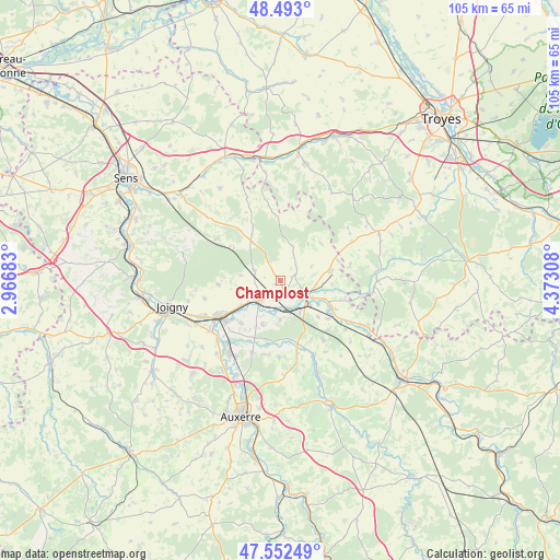
Champlost GPS coordinates[2]
48° 1' 29.604" North, 3° 40' 11.82" East
| Map corner | latitude | longitude |
|---|---|---|
| Upper-left | 48.493°, | 2.96683° |
| Center: | 48.02489°, | 3.66995° |
| Lower-right: | 47.55249°, | 4.37308° |
| Map W x H: | 104.6×104.6 km | = 65×65mi |
| max Lat: | 51.07786° ⇑40.3% North |
| Champlost: | 48.02489° |
| min Lat: | ⇓59.7% South 41.3874° |
| min Long | Champlost | max Long |
| -5.08615° | 3.66995° | 9.52242° |
| W 65.5%⇐ | ⇒34.5% E |
Elevation
Elevation of Champlost is 119 m = 390 ft, and this is 74.7 m = 245 ft below average elevation for this country.
| Max E: |
2333 m = 7654 ft | 54.1% |
| Avg. | 193.7 m = 635 ft | |
| Champlost | 119 m = 390 ft | |
Min E: |
-1 m = -3 ft | 45.9% |
See also: France elevation on elevation.city.
Geographical zone
Champlost is located in North temperate zone (between Tropic of Cancer and the Arctic Circle). Distance of this North polar circle is 2061.3 km =1280.8 mi to North.| Distance of | km | miles | from Champlost |
|---|---|---|---|
| North Pole | 4667.2 | 2900.1 | to North |
| Arctic Circle | 2061.3 | 1280.8 | to North |
| Tropic Cancer | 2733.9 | 1698.8 | to South |
| Equator | 5339.9 | 3318.1 | to South |


Nearby cities:
15 places around Champlost: (largest is in red/bold)
• Arces-Dilo
8.3 km =5.2 mi,  321°
321°
• Brienon-sur-Armançon
5.6 km =3.5 mi,  225°
225°
• Bussy-en-Othe
11.6 km =7.2 mi,  267°
267°
• Chailley
6.9 km =4.3 mi,  20°
20°
• Cheny
13 km =8.1 mi, 231°
• Germigny
8.9 km =5.5 mi,  111°
111°
• Migennes
13.1 km =8.1 mi,  239°
239°
• Mont-Saint-Sulpice
8.6 km =5.3 mi,  202°
202°
• Neuvy-Sautour
9.5 km =5.9 mi,  78°
78°
• Ormoy
10.7 km =6.6 mi,  221°
221°
• Pontigny
13.7 km =8.5 mi,  166°
166°
• Saint-Florentin
4.9 km =3 mi,  123°
123°
• Turny
5.8 km =3.6 mi, 78°
• Venizy
3.2 km =2 mi,  69°
69°
• Vergigny
7 km =4.3 mi,  149°
149°
Sources, notices
• [Note1] Compared only with cities in France existing in our database
• [Src1] Map data: © OpenStreetMap contributors (CC-BY-SA)
• [Src2] Other city data from geonames.org with taken over terms of usage.
• [Src3] Geographical zone / Annual Mean Temperature by Robert A. Rohde @ Wikipedia
