Mont-Saint-Père geodata
Mont-Saint-Père (Hauts-de-France) is a populated place; located in France in Europe/Paris (GMT+2) time zone. With population of 549 people, there are 14229 cities with bigger population in this country. Compared to other cities in France, 81.5% of cities are located further ↓South; 64.1% of cities are located further ←West and 66% of cities have higher elevation than Mont-Saint-Père. Note1
Administrative division(s):
- Level 1: Hauts-de-France
- Level 2: Département de l'Aisne
- Level 3: Arrondissement de Château-Thierry
- Level 4: Mont-Saint-Père


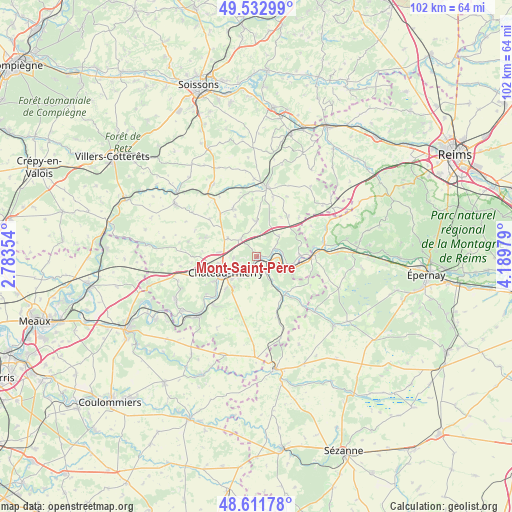
Mont-Saint-Père GPS coordinates[2]
49° 4' 28.272" North, 3° 29' 11.976" East
| Map corner | latitude | longitude |
|---|---|---|
| Upper-left | 49.53299°, | 2.78354° |
| Center: | 49.07452°, | 3.48666° |
| Lower-right: | 48.61178°, | 4.18979° |
| Map W x H: | 102.4×102.4 km | = 63.6×63.6mi |
| max Lat: | 51.07786° ⇑18.5% North |
| Mont-Saint-Père: | 49.07452° |
| min Lat: | ⇓81.5% South 41.3874° |
| min Long | Mont-Saint-Pèr | max Long |
| -5.08615° | 3.48666° | 9.52242° |
| W 64.1%⇐ | ⇒35.9% E |
Elevation
Elevation of Mont-Saint-Père is 87 m = 285 ft, and this is 106.7 m = 350 ft below average elevation for this country.
| Max E: |
2333 m = 7654 ft | 66% |
| Avg. | 193.7 m = 635 ft | |
| Mont-Saint-Père | 87 m = 285 ft | |
Min E: |
-1 m = -3 ft | 34% |
See also: France elevation on elevation.city.
Geographical zone
Mont-Saint-Père is located in North temperate zone (between Tropic of Cancer and the Arctic Circle). Distance of this North polar circle is 1944.6 km =1208.3 mi to North.| Distance of | km | miles | from Mont-Saint-Père |
|---|---|---|---|
| North Pole | 4550.5 | 2827.5 | to North |
| Arctic Circle | 1944.6 | 1208.3 | to North |
| Tropic Cancer | 2850.7 | 1771.3 | to South |
| Equator | 5456.6 | 3390.6 | to South |


Nearby cities:
15 places around Mont-Saint-Père: (largest is in red/bold)
• Beuvardes
7.5 km =4.7 mi,  1°
1°
• Brasles
5.1 km =3.2 mi,  234°
234°
• Chierry
5.7 km =3.5 mi, 226°
• Château-Thierry
6.8 km =4.2 mi,  242°
242°
• Coincy
10.6 km =6.6 mi,  333°
333°
• Condé-en-Brie
9.6 km =6 mi,  144°
144°
• Crézancy
3.4 km =2.1 mi,  149°
149°
• Dormans
11 km =6.8 mi,  90°
90°
• Essômes-sur-Marne
9.5 km =5.9 mi, 237°
• Fossoy
2.9 km =1.8 mi,  184°
184°
• Jaulgonne
3.8 km =2.4 mi,  65°
65°
• Nesles-la-Montagne
7.5 km =4.7 mi,  215°
215°
• Nogentel
8.8 km =5.5 mi, 224°
• Épaux-Bézu
10.7 km =6.6 mi,  290°
290°
• Étampes-sur-Marne
6.6 km =4.1 mi, 228°
Sources, notices
• [Note1] Compared only with cities in France existing in our database
• [Src1] Map data: © OpenStreetMap contributors (CC-BY-SA)
• [Src2] Other city data from geonames.org with taken over terms of usage.
• [Src3] Geographical zone / Annual Mean Temperature by Robert A. Rohde @ Wikipedia
