Château-Thierry geodata
Château-Thierry (Hauts-de-France) is a seat of a third-order administrative division; located in France in Europe/Paris (GMT+2) time zone. With population of 15,938 people, there are 600 cities with bigger population in this country. Compared to other cities in France, 80.8% of cities are located further ↓South; 63.3% of cities are located further ←West and 77% of cities have higher elevation than Château-Thierry. Note1
Administrative division(s):
- Level 1: Hauts-de-France
- Level 2: Département de l'Aisne
- Level 3: Arrondissement de Château-Thierry
- Level 4: Château-Thierry


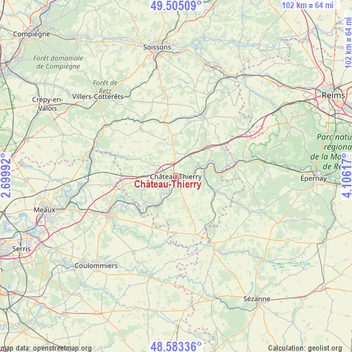
Château-Thierry GPS coordinates[2]
49° 2' 46.896" North, 3° 24' 10.944" East
| Map corner | latitude | longitude |
|---|---|---|
| Upper-left | 49.50509°, | 2.69992° |
| Center: | 49.04636°, | 3.40304° |
| Lower-right: | 48.58336°, | 4.10617° |
| Map W x H: | 102.5×102.5 km | = 63.7×63.7mi |
| max Lat: | 51.07786° ⇑19.2% North |
| Château-Thierry: | 49.04636° |
| min Lat: | ⇓80.8% South 41.3874° |
| min Long | Château-Thierr | max Long |
| -5.08615° | 3.40304° | 9.52242° |
| W 63.3%⇐ | ⇒36.7% E |
Elevation
Elevation of Château-Thierry is 62 m = 203 ft, and this is 131.7 m = 432 ft below average elevation for this country.
| Max E: |
2333 m = 7654 ft | 77% |
| Avg. | 193.7 m = 635 ft | |
| Château-Thierry | 62 m = 203 ft | |
Min E: |
-1 m = -3 ft | 23% |
See also: France elevation on elevation.city.
Geographical zone
Château-Thierry is located in North temperate zone (between Tropic of Cancer and the Arctic Circle). Distance of this North polar circle is 1947.7 km =1210.2 mi to North.| Distance of | km | miles | from Château-Thierry |
|---|---|---|---|
| North Pole | 4553.6 | 2829.5 | to North |
| Arctic Circle | 1947.7 | 1210.2 | to North |
| Tropic Cancer | 2847.5 | 1769.4 | to South |
| Equator | 5453.4 | 3388.6 | to South |


Nearby cities:
15 places around Château-Thierry: (largest is in red/bold)
• Brasles
2 km =1.2 mi,  84°
84°
• Chierry
2.1 km =1.3 mi,  111°
111°
• Chézy-sur-Marne
6.9 km =4.3 mi,  201°
201°
• Crézancy
7.8 km =4.8 mi,  88°
88°
• Domptin
9.7 km =6 mi,  249°
249°
• Essômes-sur-Marne
2.8 km =1.7 mi,  225°
225°
• Fossoy
5.9 km =3.7 mi, 87°
• Jaulgonne
10.7 km =6.6 mi,  63°
63°
• Mont-Saint-Père
6.8 km =4.2 mi, 62°
• Nesles-la-Montagne
3.4 km =2.1 mi,  150°
150°
• Nogent-l’Artaud
10.8 km =6.7 mi,  213°
213°
• Nogentel
3.2 km =2 mi,  180°
180°
• Saulchery
10.5 km =6.5 mi,  221°
221°
• Épaux-Bézu
7.9 km =4.9 mi,  329°
329°
• Étampes-sur-Marne
1.7 km =1.1 mi,  138°
138°
Sources, notices
• [Note1] Compared only with cities in France existing in our database
• [Src1] Map data: © OpenStreetMap contributors (CC-BY-SA)
• [Src2] Other city data from geonames.org with taken over terms of usage.
• [Src3] Geographical zone / Annual Mean Temperature by Robert A. Rohde @ Wikipedia
