Fossoy geodata
Fossoy (Hauts-de-France) is a populated place; located in France in Europe/Paris (GMT+2) time zone. With population of 633 people, there are 12771 cities with bigger population in this country. Compared to other cities in France, 80.9% of cities are located further ↓South; 64.1% of cities are located further ←West and 59.7% of cities have higher elevation than Fossoy. Note1
Administrative division(s):
- Level 1: Hauts-de-France
- Level 2: Département de l'Aisne
- Level 3: Arrondissement de Château-Thierry
- Level 4: Fossoy


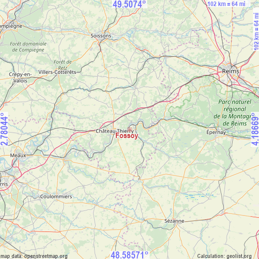
Fossoy GPS coordinates[2]
49° 2' 55.284" North, 3° 29' 0.852" East
| Map corner | latitude | longitude |
|---|---|---|
| Upper-left | 49.5074°, | 2.78044° |
| Center: | 49.04869°, | 3.48357° |
| Lower-right: | 48.58571°, | 4.18669° |
| Map W x H: | 102.5×102.5 km | = 63.7×63.7mi |
| max Lat: | 51.07786° ⇑19.1% North |
| Fossoy: | 49.04869° |
| min Lat: | ⇓80.9% South 41.3874° |
| min Long | Fossoy | max Long |
| -5.08615° | 3.48357° | 9.52242° |
| W 64.1%⇐ | ⇒35.9% E |
Elevation
Elevation of Fossoy is 103 m = 338 ft, and this is 90.7 m = 298 ft below average elevation for this country.
| Max E: |
2333 m = 7654 ft | 59.7% |
| Avg. | 193.7 m = 635 ft | |
| Fossoy | 103 m = 338 ft | |
Min E: |
-1 m = -3 ft | 40.3% |
See also: France elevation on elevation.city.
Geographical zone
Fossoy is located in North temperate zone (between Tropic of Cancer and the Arctic Circle). Distance of this North polar circle is 1947.5 km =1210.1 mi to North.| Distance of | km | miles | from Fossoy |
|---|---|---|---|
| North Pole | 4553.4 | 2829.4 | to North |
| Arctic Circle | 1947.5 | 1210.1 | to North |
| Tropic Cancer | 2847.8 | 1769.5 | to South |
| Equator | 5453.7 | 3388.8 | to South |


Nearby cities:
15 places around Fossoy: (largest is in red/bold)
• Beuvardes
10.4 km =6.5 mi,  2°
2°
• Brasles
3.9 km =2.4 mi,  269°
269°
• Chierry
4.1 km =2.5 mi,  255°
255°
• Château-Thierry
5.9 km =3.7 mi, 267°
• Chézy-sur-Marne
10.7 km =6.6 mi,  231°
231°
• Condé-en-Brie
7.6 km =4.7 mi,  130°
130°
• Crézancy
2 km =1.2 mi,  91°
91°
• Dormans
11.6 km =7.2 mi,  76°
76°
• Essômes-sur-Marne
8.2 km =5.1 mi,  254°
254°
• Jaulgonne
5.8 km =3.6 mi,  39°
39°
• Mont-Saint-Père
2.9 km =1.8 mi, 4°
• Nesles-la-Montagne
5.3 km =3.3 mi, 232°
• Nogentel
6.9 km =4.3 mi,  239°
239°
• Épaux-Bézu
11.8 km =7.3 mi,  303°
303°
• Étampes-sur-Marne
5 km =3.1 mi, 251°
Sources, notices
• [Note1] Compared only with cities in France existing in our database
• [Src1] Map data: © OpenStreetMap contributors (CC-BY-SA)
• [Src2] Other city data from geonames.org with taken over terms of usage.
• [Src3] Geographical zone / Annual Mean Temperature by Robert A. Rohde @ Wikipedia
