Montrottier geodata
Montrottier (Auvergne-Rhône-Alpes) is a populated place; located in France in Europe/Paris (GMT+2) time zone. With population of 1,479 people, there are 6254 cities with bigger population in this country. Compared to other cities in France, 69.4% of cities are located further ↑North; 71.8% of cities are located further ←West and 95.7% of cities have lower elevation than Montrottier. Note1
Administrative division(s):
- Level 1: Auvergne-Rhône-Alpes
- Level 2: Département du Rhône
- Level 3: Arrondissement de Lyon
- Level 4: Montrottier


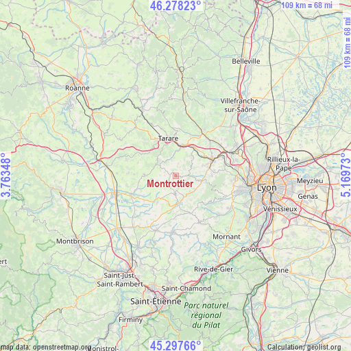
Montrottier GPS coordinates[2]
45° 47' 24.36" North, 4° 27' 59.76" East
| Map corner | latitude | longitude |
|---|---|---|
| Upper-left | 46.27823°, | 3.76348° |
| Center: | 45.7901°, | 4.4666° |
| Lower-right: | 45.29766°, | 5.16973° |
| Map W x H: | 109×109 km | = 67.7×67.7mi |
| max Lat: | 51.07786° ⇑69.4% North |
| Montrottier: | 45.7901° |
| min Lat: | ⇓30.6% South 41.3874° |
| min Long | Montrottier | max Long |
| -5.08615° | 4.4666° | 9.52242° |
| W 71.8%⇐ | ⇒28.2% E |
Elevation
Elevation of Montrottier is 625 m = 2051 ft, and this is 431.3 m = 1415 ft above average elevation for this country.
| Max E: |
2333 m = 7654 ft | 4.3% |
| Montrottier | 625 m 2051 ft | |
| Avg. | 193.7 m = 635 ft | |
Min E: |
-1 m = -3 ft | 95.7% |
See also: France elevation on elevation.city.
Geographical zone
Montrottier is located in North temperate zone (between Tropic of Cancer and the Arctic Circle). Distance of this North polar circle is 2309.8 km =1435.2 mi to North.| Distance of | km | miles | from Montrottier |
|---|---|---|---|
| North Pole | 4915.7 | 3054.5 | to North |
| Arctic Circle | 2309.8 | 1435.2 | to North |
| Tropic Cancer | 2485.5 | 1544.4 | to South |
| Equator | 5091.4 | 3163.6 | to South |


Nearby cities:
15 places around Montrottier: (largest is in red/bold)
• Ancy
6.1 km =3.8 mi,  31°
31°
• Bessenay
7 km =4.3 mi,  102°
102°
• Brullioles
4.1 km =2.5 mi,  141°
141°
• Brussieu
6.5 km =4 mi, 136°
• Chambost-Longessaigne
7.8 km =4.8 mi,  255°
255°
• Longessaigne
3.3 km =2.1 mi,  273°
273°
• Saint-Clément-les-Places
5.3 km =3.3 mi,  218°
218°
• Saint-Forgeux
7.7 km =4.8 mi,  4°
4°
• Saint-Genis-l’Argentière
9.1 km =5.7 mi,  167°
167°
• Saint-Julien-sur-Bibost
4.4 km =2.7 mi,  68°
68°
• Saint-Laurent-de-Chamousset
5.8 km =3.6 mi,  181°
181°
• Saint-Romain-de-Popey
8.1 km =5 mi,  38°
38°
• Sainte-Foy-l’Argentière
9.1 km =5.7 mi, 178°
• Savigny
8.8 km =5.5 mi, 70°
• Villechenève
5.3 km =3.3 mi,  298°
298°
Sources, notices
• [Note1] Compared only with cities in France existing in our database
• [Src1] Map data: © OpenStreetMap contributors (CC-BY-SA)
• [Src2] Other city data from geonames.org with taken over terms of usage.
• [Src3] Geographical zone / Annual Mean Temperature by Robert A. Rohde @ Wikipedia
