Montmédy geodata
Montmédy (Grand Est) is a populated place; located in France in Europe/Paris (GMT+2) time zone. With population of 2,188 people, there are 4388 cities with bigger population in this country. Compared to other cities in France, 89.6% of cities are located further ↓South; 81.3% of cities are located further ←West and 65.2% of cities have lower elevation than Montmédy. Note1
Administrative division(s):
- Level 1: Grand Est
- Level 2: Meuse
- Level 3: Arrondissement de Verdun
- Level 4: Montmédy


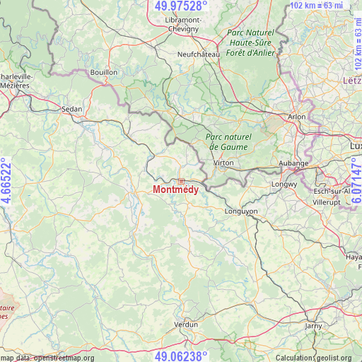
Montmédy GPS coordinates[2]
49° 31' 15.456" North, 5° 22' 6.06" East
| Map corner | latitude | longitude |
|---|---|---|
| Upper-left | 49.97528°, | 4.66522° |
| Center: | 49.52096°, | 5.36835° |
| Lower-right: | 49.06238°, | 6.07147° |
| Map W x H: | 101.5×101.5 km | = 63.1×63.1mi |
| max Lat: | 51.07786° ⇑10.4% North |
| Montmédy: | 49.52096° |
| min Lat: | ⇓89.6% South 41.3874° |
| min Long | Montmédy | max Long |
| -5.08615° | 5.36835° | 9.52242° |
| W 81.3%⇐ | ⇒18.7% E |
Elevation
Elevation of Montmédy is 195 m = 640 ft, and this is 1.3 m = 4 ft above average elevation for this country.
| Max E: |
2333 m = 7654 ft | 34.8% |
| Montmédy | 195 m 640 ft | |
| Avg. | 193.7 m = 635 ft | |
Min E: |
-1 m = -3 ft | 65.2% |
See also: France elevation on elevation.city.
Geographical zone
Montmédy is located in North temperate zone (between Tropic of Cancer and the Arctic Circle). Distance of this North polar circle is 1895 km =1177.5 mi to North.| Distance of | km | miles | from Montmédy |
|---|---|---|---|
| North Pole | 4500.8 | 2796.7 | to North |
| Arctic Circle | 1895 | 1177.5 | to North |
| Tropic Cancer | 2900.3 | 1802.2 | to South |
| Equator | 5506.2 | 3421.4 | to South |


Nearby cities:
15 places around Montmédy: (largest is in red/bold)
• Allondrelle
14.1 km =8.8 mi,  94°
94°
• Blagny
16.9 km =10.5 mi,  311°
311°
• Carignan
19 km =11.8 mi, 310°
• Damvillers
19.9 km =12.4 mi,  173°
173°
• Dun-sur-Meuse
20.2 km =12.6 mi,  220°
220°
• Longuyon
19.2 km =11.9 mi,  117°
117°
• Margut
10.4 km =6.5 mi, 310°
• Marville
9.9 km =6.2 mi,  140°
140°
• Mouzay
12.6 km =7.8 mi,  239°
239°
• Pure
22 km =13.7 mi,  320°
320°
• Stenay
13.5 km =8.4 mi,  257°
257°
• Tellancourt
19.2 km =11.9 mi, 94°
• Ville-Houdlémont
20.4 km =12.7 mi,  82°
82°
• Viviers-sur-Chiers
19.9 km =12.4 mi,  105°
105°
• Écouviez
6.7 km =4.2 mi, 82°
Sources, notices
• [Note1] Compared only with cities in France existing in our database
• [Src1] Map data: © OpenStreetMap contributors (CC-BY-SA)
• [Src2] Other city data from geonames.org with taken over terms of usage.
• [Src3] Geographical zone / Annual Mean Temperature by Robert A. Rohde @ Wikipedia
