Monthou-sur-Bièvre geodata
Monthou-sur-Bièvre (Centre) is a populated place; located in France in Europe/Paris (GMT+2) time zone. With population of 526 people, there are 14691 cities with bigger population in this country. Compared to other cities in France, 50.9% of cities are located further ↓South; 65.6% of cities are located further →East and 70.5% of cities have higher elevation than Monthou-sur-Bièvre. Note1
Administrative division(s):
- Level 1: Centre
- Level 2: Département du Loir-et-Cher
- Level 3: Arrondissement de Blois
- Level 4: Monthou-sur-Bièvre


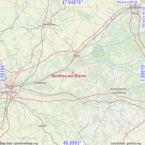
Monthou-sur-Bièvre GPS coordinates[2]
47° 28' 36.084" North, 1° 17' 42.216" East
| Map corner | latitude | longitude |
|---|---|---|
| Upper-left | 47.94978°, | 0.59194° |
| Center: | 47.47669°, | 1.29506° |
| Lower-right: | 46.9993°, | 1.99819° |
| Map W x H: | 105.7×105.7 km | = 65.7×65.7mi |
| max Lat: | 51.07786° ⇑49.1% North |
| Monthou-sur-Bièvre: | 47.47669° |
| min Lat: | ⇓50.9% South 41.3874° |
| min Long | Monthou-sur-Bi� | max Long |
| -5.08615° | 1.29506° | 9.52242° |
| W 34.4%⇐ | ⇒65.6% E |
Elevation
Elevation of Monthou-sur-Bièvre is 77 m = 253 ft, and this is 116.7 m = 383 ft below average elevation for this country.
| Max E: |
2333 m = 7654 ft | 70.5% |
| Avg. | 193.7 m = 635 ft | |
| Monthou-sur-Bièvre | 77 m = 253 ft | |
Min E: |
-1 m = -3 ft | 29.5% |
See also: France elevation on elevation.city.
Geographical zone
Monthou-sur-Bièvre is located in North temperate zone (between Tropic of Cancer and the Arctic Circle). Distance of this North polar circle is 2122.3 km =1318.7 mi to North.| Distance of | km | miles | from Monthou-sur-Bièvre |
|---|---|---|---|
| North Pole | 4728.1 | 2937.9 | to North |
| Arctic Circle | 2122.3 | 1318.7 | to North |
| Tropic Cancer | 2673 | 1660.9 | to South |
| Equator | 5278.9 | 3280.2 | to South |


Nearby cities:
15 places around Monthou-sur-Bièvre: (largest is in red/bold)
• Candé-sur-Beuvron
3.4 km =2.1 mi,  307°
307°
• Cellettes
8.6 km =5.3 mi,  48°
48°
• Chailles
7.3 km =4.5 mi,  10°
10°
• Chaumont-sur-Loire
8 km =5 mi,  273°
273°
• Chitenay
6.2 km =3.9 mi,  67°
67°
• Chouzy-sur-Cisse
6.6 km =4.1 mi,  326°
326°
• Cormeray
8.5 km =5.3 mi,  78°
78°
• Feings
6.2 km =3.9 mi,  134°
134°
• Fougères-sur-Bièvre
4.7 km =2.9 mi, 131°
• Fresnes
10 km =6.2 mi,  117°
117°
• Les Montils
2 km =1.2 mi, 5°
• Onzain
9.2 km =5.7 mi,  285°
285°
• Ouchamps
1.1 km =0.7 mi,  113°
113°
• Sambin
4.2 km =2.6 mi,  178°
178°
• Thenay
9.9 km =6.2 mi, 181°
Sources, notices
• [Note1] Compared only with cities in France existing in our database
• [Src1] Map data: © OpenStreetMap contributors (CC-BY-SA)
• [Src2] Other city data from geonames.org with taken over terms of usage.
• [Src3] Geographical zone / Annual Mean Temperature by Robert A. Rohde @ Wikipedia
