Sainte-Croix-sur-Buchy geodata
Sainte-Croix-sur-Buchy (Normandy) is a populated place; located in France in Europe/Paris (GMT+2) time zone. With population of 559 people, there are 14019 cities with bigger population in this country. Compared to other cities in France, 90.2% of cities are located further ↓South; 65% of cities are located further →East and 62.4% of cities have lower elevation than Sainte-Croix-sur-Buchy. Note1
Administrative division(s):
- Level 1: Normandy
- Level 2: Seine-Maritime
- Level 3: Arrondissement de Rouen
- Level 4: Sainte-Croix-sur-Buchy
Current local time in Sainte-Croix-sur-Buchy:
11:32 AM, SaturdayDifference from your time zone: hours


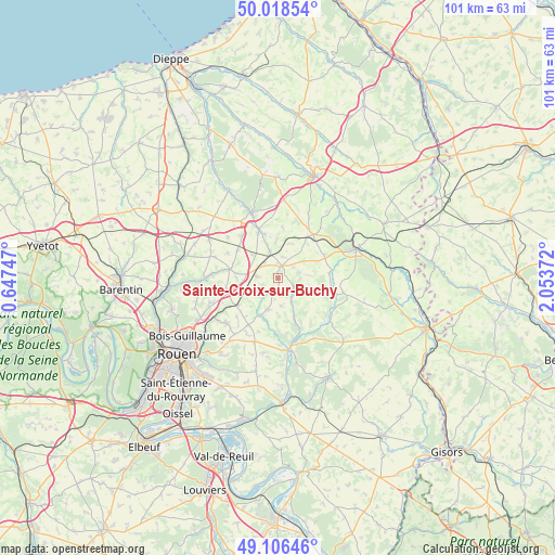
Sainte-Croix-sur-Buchy GPS coordinates[2]
49° 33' 52.668" North, 1° 21' 2.16" East
| Map corner | latitude | longitude |
|---|---|---|
| Upper-left | 50.01854°, | 0.64747° |
| Center: | 49.56463°, | 1.3506° |
| Lower-right: | 49.10646°, | 2.05372° |
| Map W x H: | 101.4×101.4 km | = 63×63mi |
| max Lat: | 51.07786° ⇑9.8% North |
| Sainte-Croix-sur-Buchy: | 49.56463° |
| min Lat: | ⇓90.2% South 41.3874° |
| min Long | Sainte-Croix-su | max Long |
| -5.08615° | 1.3506° | 9.52242° |
| W 35%⇐ | ⇒65% E |
Elevation
Elevation of Sainte-Croix-sur-Buchy is 181 m = 594 ft, and this is 12.7 m = 42 ft below average elevation for this country.
| Max E: |
2333 m = 7654 ft | 37.6% |
| Avg. | 193.7 m = 635 ft | |
| Sainte-Croix-sur-Buchy | 181 m = 594 ft | |
Min E: |
-1 m = -3 ft | 62.4% |
See also: France elevation on elevation.city.
Geographical zone
Sainte-Croix-sur-Buchy is located in North temperate zone (between Tropic of Cancer and the Arctic Circle). Distance of this North polar circle is 1890.1 km =1174.5 mi to North.| Distance of | km | miles | from Sainte-Croix-sur-Buchy |
|---|---|---|---|
| North Pole | 4496 | 2793.7 | to North |
| Arctic Circle | 1890.1 | 1174.5 | to North |
| Tropic Cancer | 2905.2 | 1805.2 | to South |
| Equator | 5511.1 | 3424.4 | to South |


Nearby cities:
15 places around Sainte-Croix-sur-Buchy: (largest is in red/bold)
• Blainville-Crevon
7.7 km =4.8 mi,  208°
208°
• Buchy
2.3 km =1.4 mi,  14°
14°
• Catenay
6 km =3.7 mi,  195°
195°
• Estouteville-Écalles
3.9 km =2.4 mi,  318°
318°
• Montérolier
7.4 km =4.6 mi,  357°
357°
• Morgny-la-Pommeraye
9.1 km =5.7 mi,  229°
229°
• Rocquemont
6.5 km =4 mi,  311°
311°
• Ry
10.4 km =6.5 mi,  183°
183°
• Saint-André-sur-Cailly
9.7 km =6 mi,  258°
258°
• Saint-Lucien
9.4 km =5.8 mi,  131°
131°
• Saint-Martin-Osmonville
9 km =5.6 mi,  335°
335°
• Servaville-Salmonville
11.4 km =7.1 mi, 210°
• Sigy-en-Bray
10.2 km =6.3 mi,  101°
101°
• Sommery
10.1 km =6.3 mi,  39°
39°
• Vieux-Manoir
3.9 km =2.4 mi,  276°
276°
Sources, notices
• [Note1] Compared only with cities in France existing in our database
• [Src1] Map data: © OpenStreetMap contributors (CC-BY-SA)
• [Src2] Other city data from geonames.org with taken over terms of usage.
• [Src3] Geographical zone / Annual Mean Temperature by Robert A. Rohde @ Wikipedia
