Montcuq geodata
Montcuq (Occitanie) is a populated place; located in France in Europe/Paris (GMT+2) time zone. With population of 1,396 people, there are 6623 cities with bigger population in this country. Compared to other cities in France, 84.6% of cities are located further ↑North; 66.7% of cities are located further →East and 67.8% of cities have lower elevation than Montcuq. Note1
Administrative division(s):
- Level 1: Occitanie
- Level 2: Lot
- Level 3: Arrondissement de Cahors
- Level 4: Montcuq-en-Quercy-Blanc


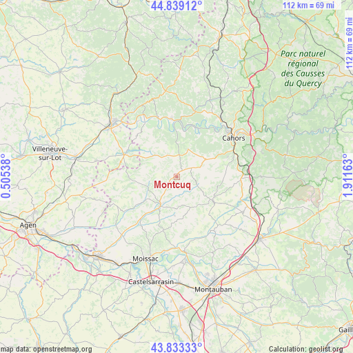
Montcuq GPS coordinates[2]
44° 20' 18.168" North, 1° 12' 30.6" East
| Map corner | latitude | longitude |
|---|---|---|
| Upper-left | 44.83912°, | 0.50538° |
| Center: | 44.33838°, | 1.2085° |
| Lower-right: | 43.83333°, | 1.91163° |
| Map W x H: | 111.8×111.8 km | = 69.5×69.5mi |
| max Lat: | 51.07786° ⇑84.6% North |
| Montcuq: | 44.33838° |
| min Lat: | ⇓15.4% South 41.3874° |
| min Long | Montcuq | max Long |
| -5.08615° | 1.2085° | 9.52242° |
| W 33.3%⇐ | ⇒66.7% E |
Elevation
Elevation of Montcuq is 208 m = 682 ft, and this is 14.3 m = 47 ft above average elevation for this country.
| Max E: |
2333 m = 7654 ft | 32.2% |
| Montcuq | 208 m 682 ft | |
| Avg. | 193.7 m = 635 ft | |
Min E: |
-1 m = -3 ft | 67.8% |
See also: France elevation on elevation.city.
Geographical zone
Montcuq is located in North temperate zone (between Tropic of Cancer and the Arctic Circle). Distance of this Northern Tropic circle is 2324 km =1444.1 mi to South.| Distance of | km | miles | from Montcuq |
|---|---|---|---|
| North Pole | 5077.1 | 3154.8 | to North |
| Arctic Circle | 2471.2 | 1535.5 | to North |
| Tropic Cancer | 2324 | 1444.1 | to South |
| Equator | 4930 | 3063.4 | to South |


Nearby cities:
15 places around Montcuq: (largest is in red/bold)
• Albas
14.7 km =9.1 mi,  8°
8°
• Castelnau-Montratier
14.9 km =9.3 mi,  122°
122°
• Cazes-Mondenard
12.4 km =7.7 mi,  182°
182°
• Douelle
18.9 km =11.7 mi,  39°
39°
• Durfort-Lacapelette
18.2 km =11.3 mi,  199°
199°
• Labastide-Marnhac
16.2 km =10.1 mi,  69°
69°
• Lauzerte
10.8 km =6.7 mi,  211°
211°
• Le Montat
19.7 km =12.2 mi,  76°
76°
• Luzech
16.7 km =10.4 mi,  21°
21°
• Montaigu-de-Quercy
15.2 km =9.4 mi,  270°
270°
• Montesquieu
19.9 km =12.4 mi,  217°
217°
• Prayssac
18.5 km =11.5 mi,  355°
355°
• Puy-l’Évêque
19.3 km =12 mi,  343°
343°
• Trespoux-Rassiels
15.8 km =9.8 mi,  58°
58°
• Vazerac
17.6 km =10.9 mi,  159°
159°
Sources, notices
• [Note1] Compared only with cities in France existing in our database
• [Src1] Map data: © OpenStreetMap contributors (CC-BY-SA)
• [Src2] Other city data from geonames.org with taken over terms of usage.
• [Src3] Geographical zone / Annual Mean Temperature by Robert A. Rohde @ Wikipedia
