Le Montat geodata
Le Montat (Occitanie) is a populated place; located in France in Europe/Paris (GMT+2) time zone. With population of 980 people, there are 8985 cities with bigger population in this country. Compared to other cities in France, 84.4% of cities are located further ↑North; 63.7% of cities are located further →East and 77.5% of cities have lower elevation than Le Montat. Note1
Administrative division(s):
- Level 1: Occitanie
- Level 2: Lot
- Level 3: Arrondissement de Cahors
- Level 4: Le Montat


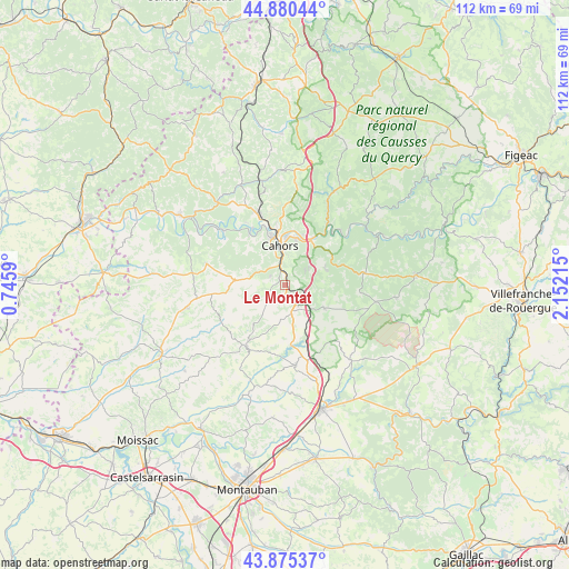
Le Montat GPS coordinates[2]
44° 22' 48.216" North, 1° 26' 56.508" East
| Map corner | latitude | longitude |
|---|---|---|
| Upper-left | 44.88044°, | 0.7459° |
| Center: | 44.38006°, | 1.44903° |
| Lower-right: | 43.87537°, | 2.15215° |
| Map W x H: | 111.8×111.8 km | = 69.5×69.5mi |
| max Lat: | 51.07786° ⇑84.4% North |
| Le Montat: | 44.38006° |
| min Lat: | ⇓15.6% South 41.3874° |
| min Long | Le Montat | max Long |
| -5.08615° | 1.44903° | 9.52242° |
| W 36.3%⇐ | ⇒63.7% E |
Elevation
Elevation of Le Montat is 268 m = 879 ft, and this is 74.3 m = 244 ft above average elevation for this country.
| Max E: |
2333 m = 7654 ft | 22.5% |
| Le Montat | 268 m 879 ft | |
| Avg. | 193.7 m = 635 ft | |
Min E: |
-1 m = -3 ft | 77.5% |
See also: France elevation on elevation.city.
Geographical zone
Le Montat is located in North temperate zone (between Tropic of Cancer and the Arctic Circle). Distance of this Northern Tropic circle is 2328.7 km =1447 mi to South.| Distance of | km | miles | from Le Montat |
|---|---|---|---|
| North Pole | 5072.5 | 3151.9 | to North |
| Arctic Circle | 2466.6 | 1532.7 | to North |
| Tropic Cancer | 2328.7 | 1447 | to South |
| Equator | 4934.6 | 3066.2 | to South |


Nearby cities:
15 places around Le Montat: (largest is in red/bold)
• Arcambal
9.8 km =6.1 mi,  31°
31°
• Belfort-du-Quercy
14.5 km =9 mi,  148°
148°
• Cahors
7.7 km =4.8 mi,  352°
352°
• Caillac
14.4 km =8.9 mi,  328°
328°
• Castelnau-Montratier
14.2 km =8.8 mi,  207°
207°
• Douelle
12.2 km =7.6 mi,  324°
324°
• Espère
15.8 km =9.8 mi,  337°
337°
• Flaujac-Poujols
4.9 km =3 mi,  55°
55°
• Labastide-Marnhac
4 km =2.5 mi,  282°
282°
• Lalbenque
8.9 km =5.5 mi,  120°
120°
• Lamagdelaine
10.2 km =6.3 mi,  17°
17°
• Laroque-des-Arcs
10.8 km =6.7 mi,  8°
8°
• Mercuès
13.9 km =8.6 mi, 338°
• Pradines
12.1 km =7.5 mi, 341°
• Trespoux-Rassiels
6.7 km =4.2 mi,  302°
302°
Sources, notices
• [Note1] Compared only with cities in France existing in our database
• [Src1] Map data: © OpenStreetMap contributors (CC-BY-SA)
• [Src2] Other city data from geonames.org with taken over terms of usage.
• [Src3] Geographical zone / Annual Mean Temperature by Robert A. Rohde @ Wikipedia
