Miribel geodata
Miribel (Auvergne-Rhône-Alpes) is a populated place; located in France in Europe/Paris (GMT+2) time zone. With population of 9,282 people, there are 1033 cities with bigger population in this country. Compared to other cities in France, 68.9% of cities are located further ↑North; 77.2% of cities are located further ←West and 63.6% of cities have lower elevation than Miribel. Note1
Administrative division(s):
- Level 1: Auvergne-Rhône-Alpes
- Level 2: Département de l'Ain
- Level 3: Arrondissement de Bourg-en-Bresse
- Level 4: Miribel


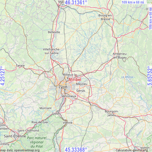
Miribel GPS coordinates[2]
45° 49' 32.88" North, 4° 57' 15.84" East
| Map corner | latitude | longitude |
|---|---|---|
| Upper-left | 46.31361°, | 4.25127° |
| Center: | 45.8258°, | 4.9544° |
| Lower-right: | 45.33368°, | 5.65752° |
| Map W x H: | 109×109 km | = 67.7×67.7mi |
| max Lat: | 51.07786° ⇑68.9% North |
| Miribel: | 45.8258° |
| min Lat: | ⇓31.1% South 41.3874° |
| min Long | Miribel | max Long |
| -5.08615° | 4.9544° | 9.52242° |
| W 77.2%⇐ | ⇒22.8% E |
Elevation
Elevation of Miribel is 187 m = 614 ft, and this is 6.7 m = 22 ft below average elevation for this country.
| Max E: |
2333 m = 7654 ft | 36.4% |
| Avg. | 193.7 m = 635 ft | |
| Miribel | 187 m = 614 ft | |
Min E: |
-1 m = -3 ft | 63.6% |
See also: France elevation on elevation.city.
Geographical zone
Miribel is located in North temperate zone (between Tropic of Cancer and the Arctic Circle). Distance of this North polar circle is 2305.8 km =1432.8 mi to North.| Distance of | km | miles | from Miribel |
|---|---|---|---|
| North Pole | 4911.7 | 3052 | to North |
| Arctic Circle | 2305.8 | 1432.8 | to North |
| Tropic Cancer | 2489.4 | 1546.8 | to South |
| Equator | 5095.4 | 3166.1 | to South |


Nearby cities:
15 places around Miribel: (largest is in red/bold)
• Beynost
3.6 km =2.2 mi,  72°
72°
• Cailloux-sur-Fontaines
6.9 km =4.3 mi,  295°
295°
• Décines-Charpieu
6.4 km =4 mi,  176°
176°
• Fontaines-Saint-Martin
8.1 km =5 mi,  284°
284°
• Jonage
7.9 km =4.9 mi,  114°
114°
• La Boisse
6.6 km =4.1 mi, 73°
• Meyzieu
7.6 km =4.7 mi,  150°
150°
• Niévroz
8.3 km =5.2 mi,  90°
90°
• Rillieux-la-Pape
4.3 km =2.7 mi,  256°
256°
• Saint-Maurice-de-Beynost
2 km =1.2 mi,  61°
61°
• Sathonay-Camp
6.2 km =3.9 mi,  268°
268°
• Sathonay-Village
6 km =3.7 mi, 278°
• Thil
5.5 km =3.4 mi,  104°
104°
• Tramoyes
5.6 km =3.5 mi,  8°
8°
• Vaulx-en-Velin
4.9 km =3 mi,  207°
207°
Sources, notices
• [Note1] Compared only with cities in France existing in our database
• [Src1] Map data: © OpenStreetMap contributors (CC-BY-SA)
• [Src2] Other city data from geonames.org with taken over terms of usage.
• [Src3] Geographical zone / Annual Mean Temperature by Robert A. Rohde @ Wikipedia
